drawing, print, ink, engraving
#
drawing
#
baroque
# print
#
ink
#
cityscape
#
engraving
Dimensions: height 432 mm, width 568 mm
Copyright: Rijks Museum: Open Domain
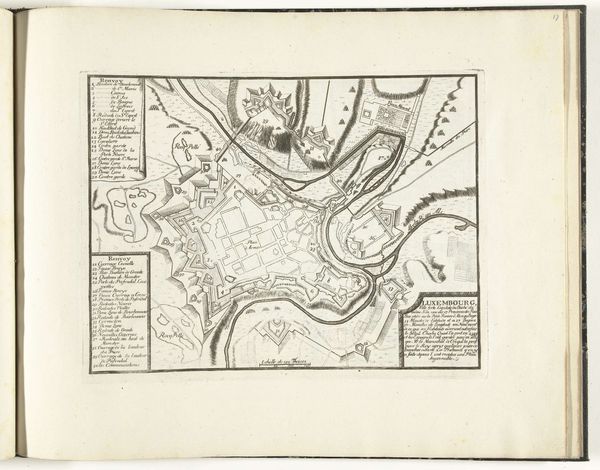
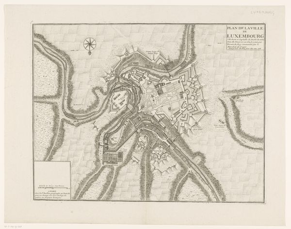
Editor: Here we have "Vestingplattegrond van Luxemburg," a cityscape made in 1748 by an anonymous artist. It looks like a map rendered through engraving and ink, incredibly detailed. It’s amazing how much detail is packed in there. What can you tell me about it? Curator: Indeed, the level of detail is compelling. This isn’t just a map; it’s a statement about power and control during the Baroque era. Think about the context: fortifications were crucial, and meticulously mapping a city's defenses was a strategic act. This print was likely commissioned or circulated among military officials and elites. Editor: So it served a political function? Beyond simply showing where things are located. Curator: Absolutely. Consider how the cartographer highlights the elaborate bastions and walls. This isn’t merely geographic accuracy; it's about projecting an image of invincibility and authority. The artistry serves to glorify military engineering and the power of the state. Note how the decorative flourishes around the title reinforce this sense of grandeur. Why do you think the engraver paid so much attention to the shadows and textures? Editor: Maybe to emphasize the three-dimensionality, to make the fortifications seem even more imposing? It’s almost like propaganda. Curator: Precisely. The "Vestingplattegrond van Luxemburg" reveals much about 18th-century power dynamics, as visual media were carefully deployed to bolster authority and impress viewers. The intersection of art, military strategy, and political messaging here is quite rich. Editor: I never considered a map could be so expressive, so loaded with political intention! It's definitely made me rethink how I view historical documents. Curator: And that is precisely the point – to consider how art reflects and shapes our understanding of history.
Comments
No comments
Be the first to comment and join the conversation on the ultimate creative platform.
More like this