About this artwork
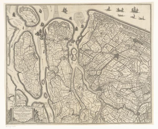
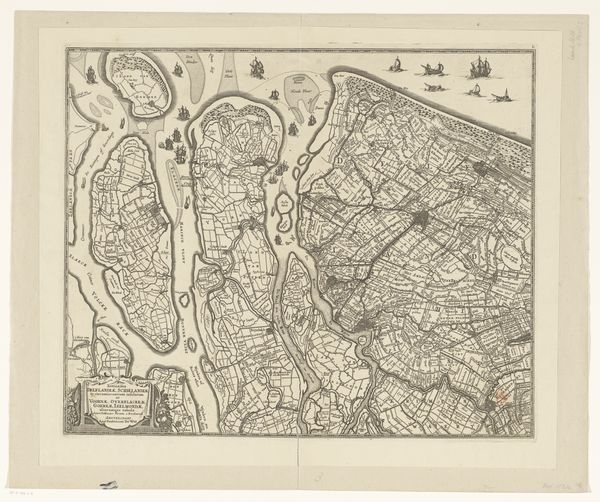
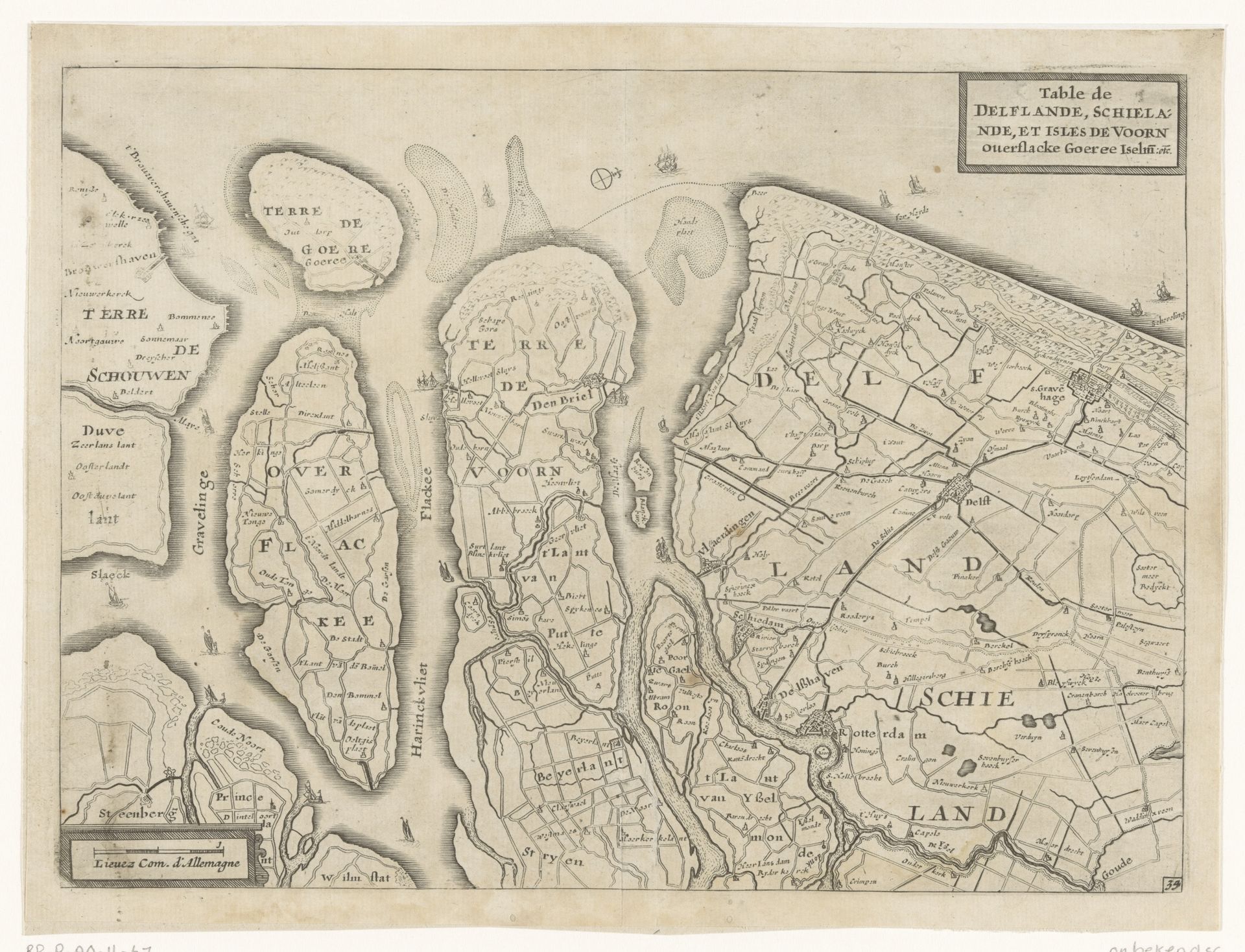
This map of Delfland, Schieland, and the South Holland Islands, crafted by an anonymous hand, presents us with more than mere geography. It evokes the timeless struggle between land and sea. Observe how the land is meticulously divided, each parcel carefully delineated, as if humanity seeks to impose order upon the fluidity of nature. These divisions remind us of the Roman grid systems used in conquered territories, a symbol of control echoing through centuries. But consider also the sea, the ever-present threat, symbolized by the ships, bearing a primal power that transcends temporal boundaries. This duality—order versus chaos, control versus nature—reappears throughout history, from the gardens of Versailles to the abstract expressionism of the 20th century. It is a reflection of our internal psychological battle, the Apollonian and Dionysian forces vying for dominance within the human soul. This map is not just a representation of space; it’s a cartography of the human psyche, navigating the shifting landscapes of our collective fears and aspirations.
Kaart van Delfland, Schieland en de Zuid-Hollandse eilanden
c. 1635 - 1696
Anonymous
@anonymousLocation
RijksmuseumArtwork details
- Medium
- graphic-art, print, engraving
- Dimensions
- height 169 mm, width 232 mm
- Location
- Rijksmuseum
- Copyright
- Rijks Museum: Open Domain
Tags
Comments
Share your thoughts
About this artwork
This map of Delfland, Schieland, and the South Holland Islands, crafted by an anonymous hand, presents us with more than mere geography. It evokes the timeless struggle between land and sea. Observe how the land is meticulously divided, each parcel carefully delineated, as if humanity seeks to impose order upon the fluidity of nature. These divisions remind us of the Roman grid systems used in conquered territories, a symbol of control echoing through centuries. But consider also the sea, the ever-present threat, symbolized by the ships, bearing a primal power that transcends temporal boundaries. This duality—order versus chaos, control versus nature—reappears throughout history, from the gardens of Versailles to the abstract expressionism of the 20th century. It is a reflection of our internal psychological battle, the Apollonian and Dionysian forces vying for dominance within the human soul. This map is not just a representation of space; it’s a cartography of the human psyche, navigating the shifting landscapes of our collective fears and aspirations.
Comments
Share your thoughts