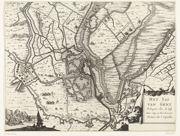
print, engraving
#
dutch-golden-age
# print
#
landscape
#
geometric
#
engraving
Dimensions: height 156 mm, width 233 mm
Copyright: Rijks Museum: Open Domain
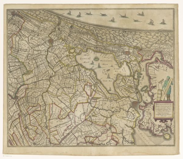
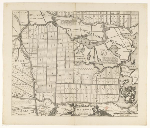
Curator: Here at the Rijksmuseum, we have an intriguing engraving simply known as "Kaart van Rijnland en Amstelland," which roughly translates to "Map of Rhineland and Amstelland." It was likely created sometime between 1635 and 1696. What are your immediate thoughts? Editor: The immediate impact is, paradoxically, both rigid and dreamlike. The land looks almost like graph paper with the divisions, yet there is a delicacy, like looking at a spiderweb spun with mathematical precision. You almost expect to see a tiny gnome tending each parcel! Curator: That sense of precision is partly because this isn’t just a piece of art but also an object illustrating an emerging social and economic order. This isn't just cartography for exploration; it visualizes land as property, ripe for agricultural or commercial exploitation. Think of the material resources involved in mapping, engraving, and distributing such images. The sheer organizational power behind this print is remarkable. Editor: You're so right; one has to look at how this engraving uses simple lines and text to assert ownership. But, from my perspective, I imagine the cartographer imbued with a sort of artistic license—an artist imposing human order, a kind of god-like hand, on a chaotic nature, deciding, with a stroke, where a field ends and a waterway begins. Does that resonate at all, or am I going off on a tangent? Curator: No, that’s insightful. The human element, and its potential for both good and the rather more sinister "mastering of nature" narrative, is undeniably there. The density of the lines also alludes to an obsessive labor, marking territories, solidifying claims. What looks so clean and ordered has behind it labor that is very likely coerced. Editor: Exactly. So much beauty, ingenuity, labor… all geared towards dividing, owning. It's a complicated sensation to wrestle with as a viewer, isn't it? It seems to be capturing so much of the period that birthed it! Curator: Indeed. And considering its deceptively simple appearance, it packs quite the analytical punch, all wrapped up in neat little lines. Thank you.
Comments
No comments
Be the first to comment and join the conversation on the ultimate creative platform.
More like this