print, etching, ink, engraving
#
baroque
# print
#
etching
#
ink
#
14_17th-century
#
cityscape
#
engraving
Dimensions: height 203 mm, width 266 mm
Copyright: Rijks Museum: Open Domain
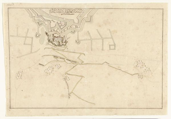
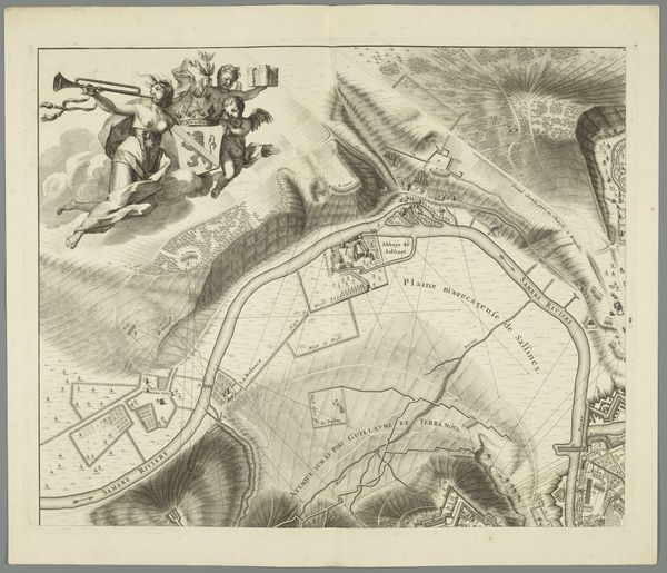
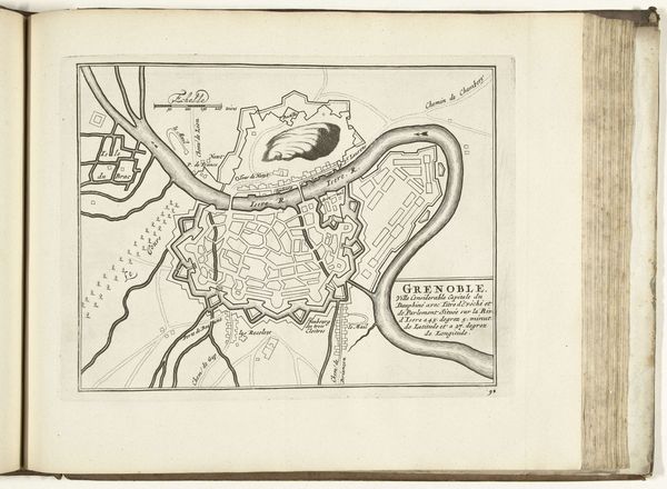
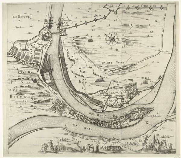
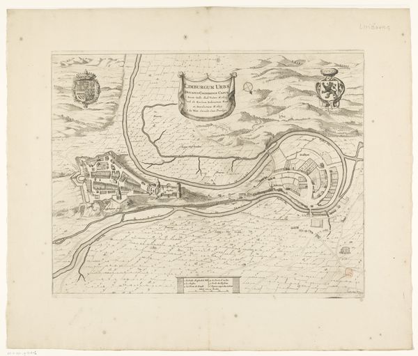
Editor: This is a fascinating etched map, "Plattegrond van Dinant, 1693" by Harmanus van Loon. It feels very formal and strategic. The print has that recognizable old-paper quality. The cartography is elaborate with a dedication and legends in French! What can you tell me about why an image like this was created? Curator: These city plans, particularly in the Baroque period, are not just geographic representations. They're assertions of power. This one denotes Dinant under the Prince-Bishopric of Liège's authority but notes it ceded to the King. Editor: I see what you mean. Curator: Notice the detailed fortifications. Mapping was deeply intertwined with military strategy and control. This etching shows how cities were viewed as strategic assets, especially given the constant power struggles of the era. Look closely at the river's placement and defensive structures; how does that inform your understanding? Editor: It emphasizes Dinant's vulnerability, and, on the other hand, its protection through citadels and walls. Curator: Exactly. These visual elements legitimize authority, documenting physical control, military capability and thus solidifying political influence. What do you think was the role of such maps, beyond mere record keeping? Editor: So, these prints functioned as both records and symbols of control? I’m realizing how powerfully these images communicate political messaging! Curator: Precisely! By studying the social and political context, we recognize how something as seemingly neutral as a map is truly embedded with intent and the ambitions of its time. It's about how imagery participates in historical narratives. Editor: That's a great takeaway, I never considered it that way. I’ll definitely approach maps in museums differently from now on.
Comments
No comments
Be the first to comment and join the conversation on the ultimate creative platform.
More like this