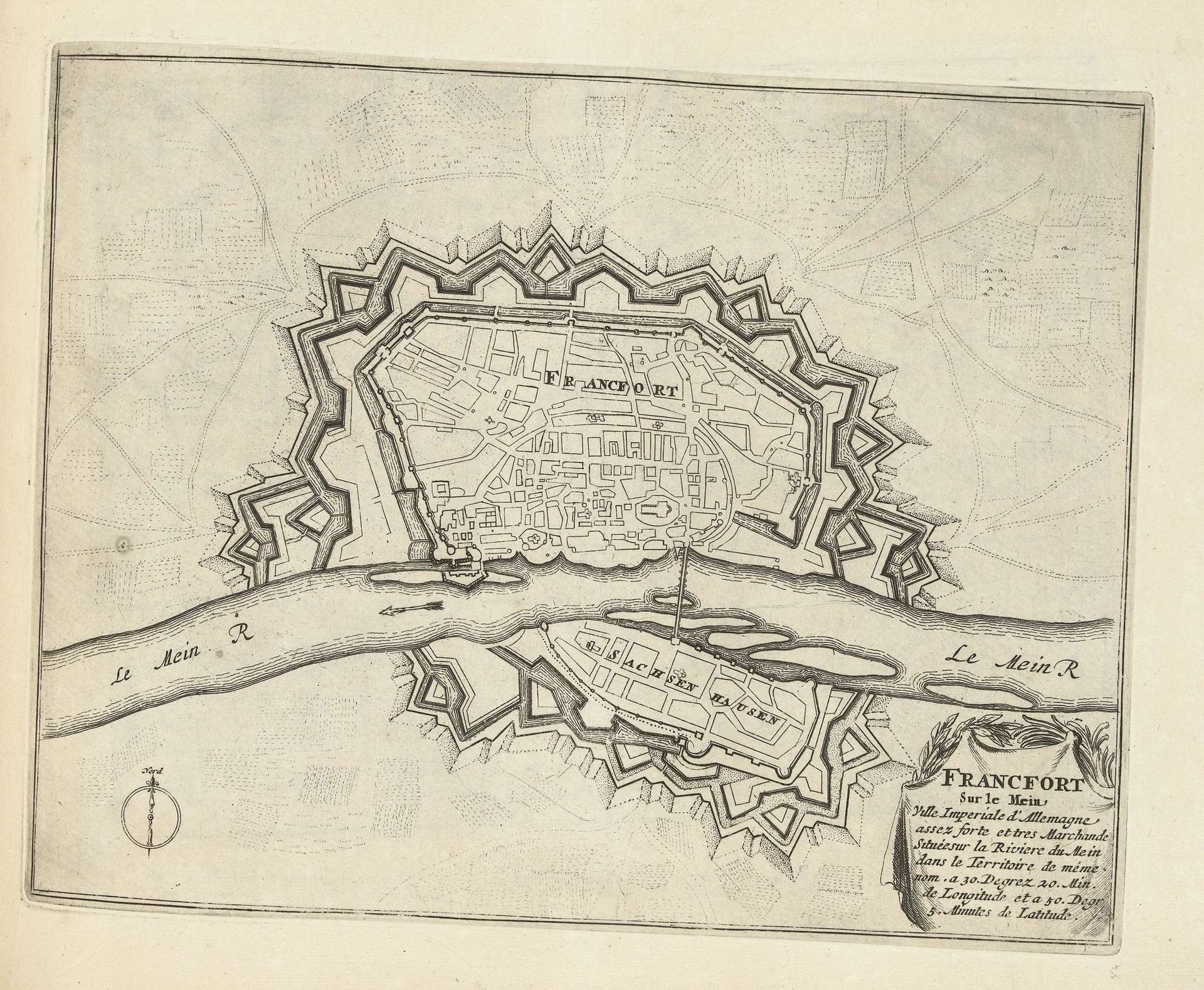
1693 - 1696
Plattegrond van Frankfurt am Main, ca. 1693-1696
Anonymous
@anonymousLocation
RijksmuseumListen to curator's interpretation
Curatorial notes
Curator: This exquisite map, dating from around 1693-1696, offers a fascinating bird's-eye view of Frankfurt am Main. It's an anonymous work, rendered in ink as an engraving. What are your initial impressions? Editor: It's immediately striking how the severe geometric precision contrasts with what I imagine to be a bustling city. The rigid lines and calculated angles give it a sense of order, almost like a fortification plan rather than a simple city map. Curator: Precisely. These elements – the geometric layout, the fortifications – are all key components in the representation of power and control during the Baroque period. Notice how the river Main bisects the space, but the city remains clearly defined within its structured walls. Editor: Indeed. The lines become boundaries, reinforcing social hierarchies and trade routes. There is the visual suggestion here that nothing is beyond the purview of the engraver. What I also see is that the old engraving style uses hatching and line weights to define form and space. It's functional, of course, but possesses a kind of understated aesthetic all its own. Curator: I agree. And think about the public function such engravings served. In an age before photography, such precisely rendered maps helped shape public perceptions of cities. They became tools for governance and promoting civic pride. We can think about the role the river plays, its impact upon city culture and lifeblood—allowing goods and people to travel both east and west along Europe’s interior. Editor: That contextual understanding truly elevates the formal aspects of the map itself. Seeing it as more than just lines and spaces allows us to consider Frankfurt’s evolution and influence. In some ways it prefigures a more diagrammatic urban model that is seen more and more from the Enlightenment era and beyond. Curator: Ultimately, this map represents more than just a place. It symbolizes the aspirations, defenses, and societal structures of an era. And through the formal precision of its execution, those things all resonate still. Editor: Absolutely. The intersection of art, history, and cartography gives it an intellectual vibrancy, inviting us to interpret not only Frankfurt, but a moment in time.