drawing, print, ink, engraving
#
drawing
#
baroque
# print
#
ink
#
cityscape
#
engraving
Dimensions: height 540 mm, width 630 mm
Copyright: Rijks Museum: Open Domain
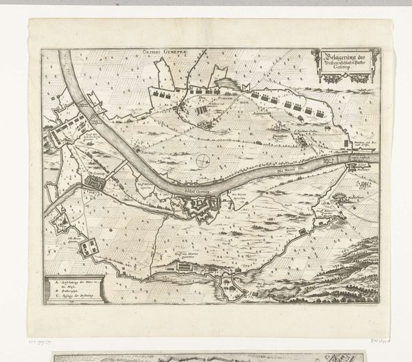
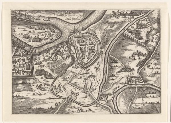
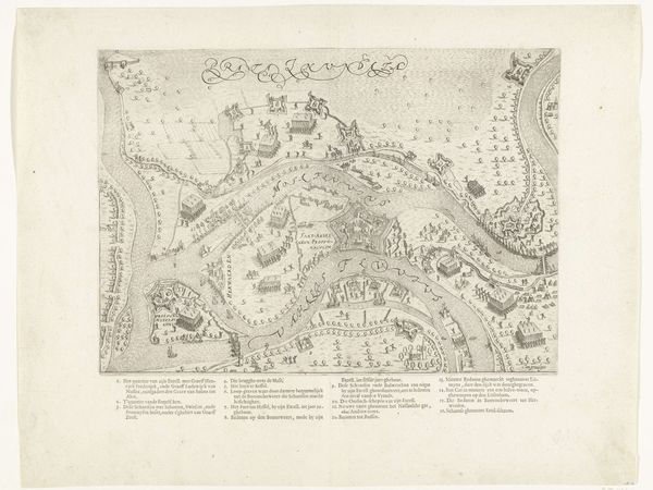
This detailed map of the siege of Namur, created in 1695 by Gilliam van der Gouwen, presents a fascinating interplay between topographical precision and symbolic representation. Its monochrome palette emphasizes the intricate linework, delineating fortifications, rivers, and landscapes with remarkable clarity. This evokes a sense of order and strategic intent. The map’s composition, however, transcends mere utility. Note how the upper-left corner features allegorical figures. They disrupt the otherwise pragmatic rendering of space. The map is divided into clearly demarcated regions and uses a system of signs to convey military and geographical information. Here, the map becomes a symbolic text, reflecting the era's preoccupation with control and knowledge. Look closely at how the linear structures of the fortifications contrast with the natural curves of the rivers. Consider too how these elements might challenge fixed notions of space and power. It is through such formal tensions that the map opens itself to broader cultural and philosophical interpretations, reminding us that even the most functional objects are embedded with layers of meaning.
Comments
No comments
Be the first to comment and join the conversation on the ultimate creative platform.
More like this