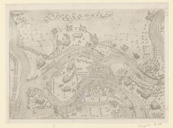
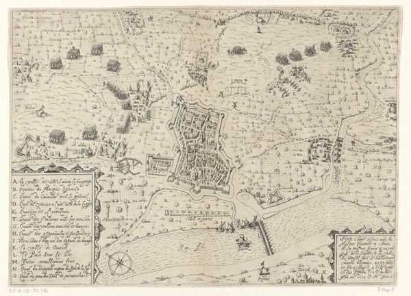
Plattegrond van Maastricht, veroverd door de Fransen in 1673 1672 - 1673
0:00
0:00
gasparbouttats
Rijksmuseum
drawing, print, ink, engraving
#
drawing
#
baroque
# print
#
pen sketch
#
ink
#
cityscape
#
engraving
Dimensions: height 184 mm, width 265 mm
Copyright: Rijks Museum: Open Domain
Gaspar Bouttats made this print of Maastricht, captured by the French in 1673, using etching. This map offers insight into the political and military strategies of 17th-century Europe. The detailed rendering of fortifications reflects the era’s preoccupation with military engineering. Created in the Dutch Republic, a hub of cartography, this map embodies the intersection of art, science, and politics. It served not only as a record of conquest but also as a tool for strategic planning and propaganda. Examining the map, one might consider its role in shaping public perception of military power and national identity during a time of intense geopolitical rivalry. It would be interesting to investigate the archives of military academies and state collections, to learn more about the use and circulation of maps such as these, and their function in power dynamics.
Comments
No comments
Be the first to comment and join the conversation on the ultimate creative platform.
More like this