drawing, graphic-art, print, paper, engraving
#
drawing
#
graphic-art
#
dutch-golden-age
# print
#
pen sketch
#
paper
#
geometric
#
history-painting
#
engraving
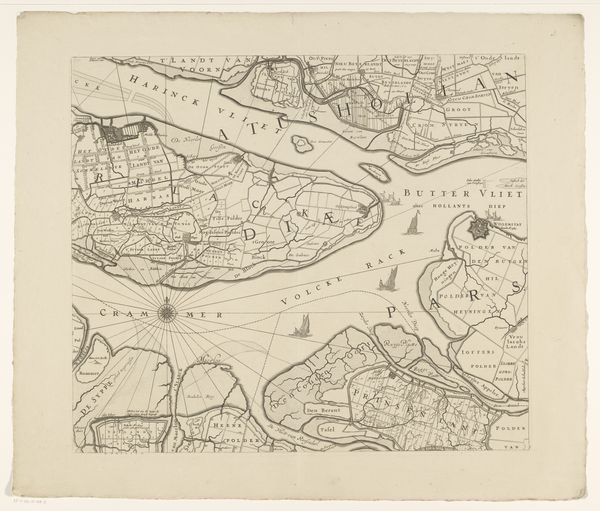
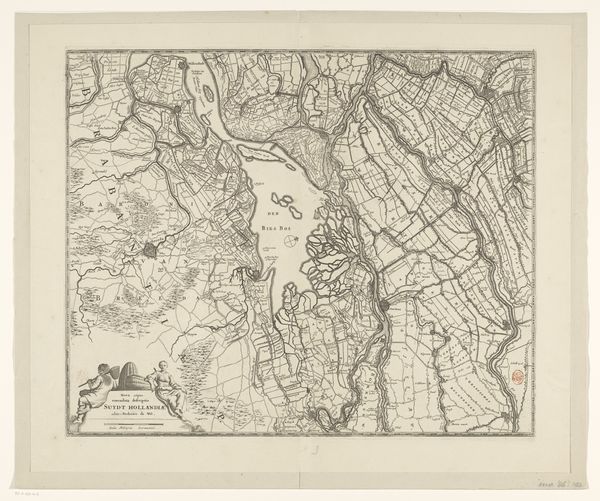
Dimensions: height 1393 mm, width 1595 mm
Copyright: Rijks Museum: Open Domain
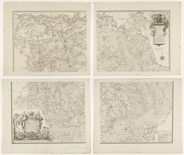
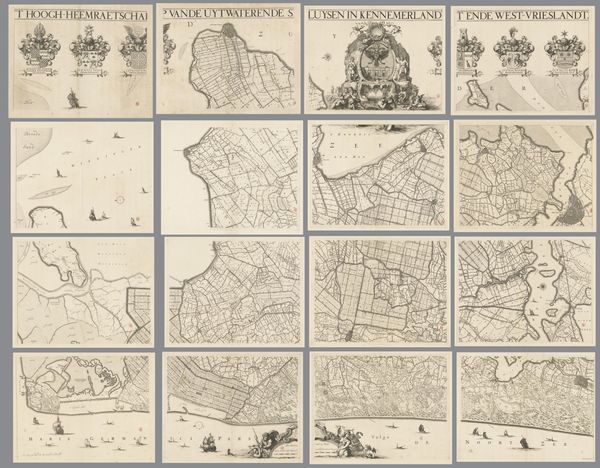
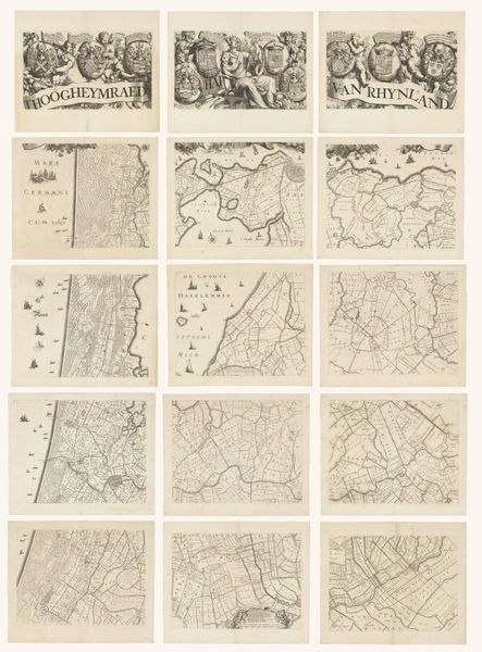
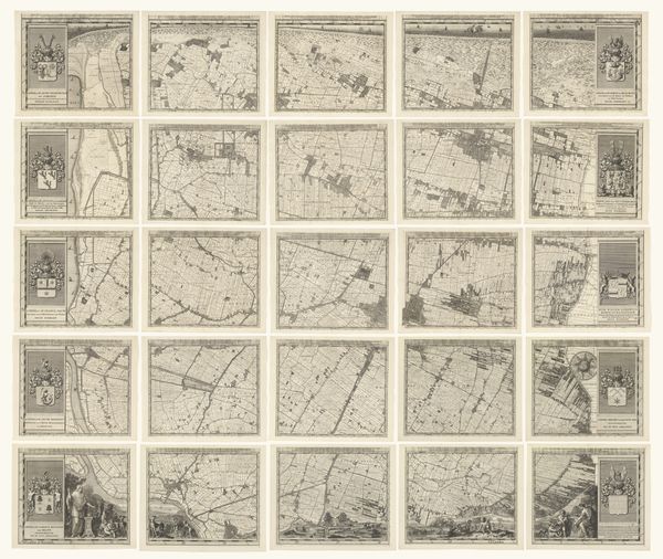
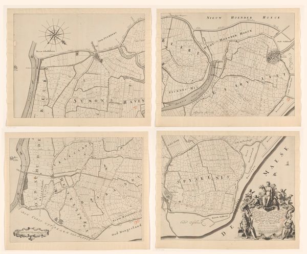
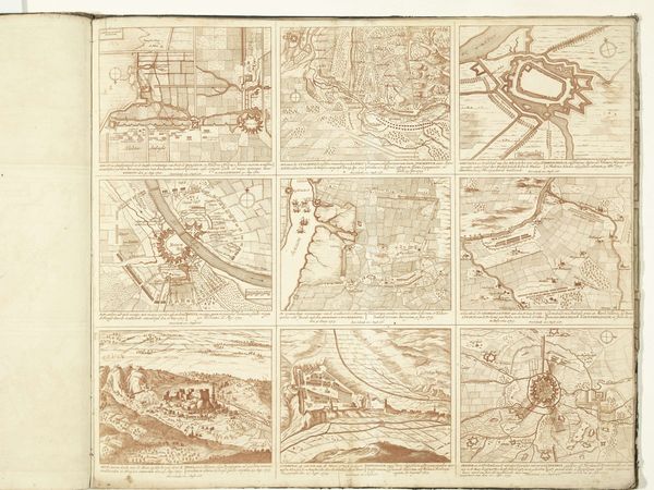
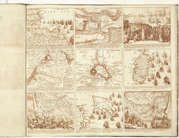
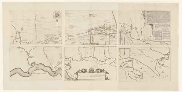
Curator: Looking at "Kaart van Zeeland, bestaande uit negen delen," dating roughly from 1655 to 1725, in the Rijksmuseum collection, what strikes you first? Editor: It’s incredibly detailed! A set of what looks like nine map tiles forming the province of Zeeland. All these finely etched lines must have taken ages to produce. You can almost feel the patience of the craftsman. Curator: Exactly. Each panel, created as an engraving, would have been printed and perhaps sold individually. We need to consider the economic drivers for creating and disseminating such cartography during the Dutch Golden Age. Who was buying these? Editor: Wealthy merchants, navigators… people directly involved in maritime trade, I'd imagine. Having access to accurate maps held practical and symbolic power. Beyond mere geographical details, consider the artistry embedded in representing territory and maritime authority. Curator: True. But, how do the materials – the paper, ink, and printing press used to create these maps influence our understanding? Were they common? Was there a workshop with multiple artisans involved in creating these sets? Were the engravers paid fairly for the highly specialized labor required? Editor: Those are excellent questions! This map offered detailed geographic data while bolstering national identity and projecting dominance. We need to explore the institutional context: Were there state-sponsored initiatives or private cartography firms at the heart of this project? The political stakes were certainly palpable. Curator: Yes, by examining the economic investment in materials and labor we see more clearly that these maps played an important part in supporting the Netherlands's maritime power during that period. These images show the real engine of industry. Editor: I agree, studying these maps helps us understand how social, cultural, and artistic aspects reflect broader changes and values in Dutch history. Curator: For me, examining these maps with attention to the work and economics involved in map production underscores their true nature. Editor: For me, the key is grasping Zeeland's context within larger systems of knowledge production.
Comments
No comments
Be the first to comment and join the conversation on the ultimate creative platform.
More like this