drawing, ink
#
drawing
#
baroque
#
ink
#
cityscape
Dimensions: height 226 mm, width 288 mm
Copyright: Rijks Museum: Open Domain
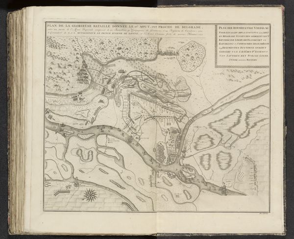
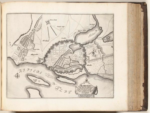
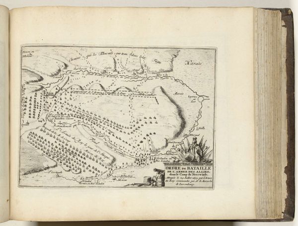
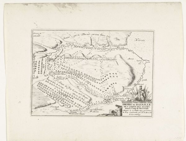
This is an anonymous map of Gerona, made in 1694. At first glance it looks like a technical document, a tool for navigation and military strategy. But let’s consider the complex power dynamics at play in its creation and use. Gerona, a city in Catalonia, was a contested territory between Spain and France. This map embodies the 17th century's political tensions and colonial ambitions. Its creation is an act of claiming space, defining borders, and asserting control over a region and its people. The map reduces a lived, complex space into a series of strategic points and lines. Think of it as an early form of surveillance, turning the city and its inhabitants into objects of scrutiny. What stories are silenced by this seemingly objective representation? The map invites us to reflect on the relationship between knowledge, power, and representation. Who gets to define whose space, and what are the consequences of that definition?
Comments
No comments
Be the first to comment and join the conversation on the ultimate creative platform.
More like this