print, engraving
#
baroque
# print
#
history-painting
#
engraving
Dimensions: height 215 mm, width 272 mm
Copyright: Rijks Museum: Open Domain
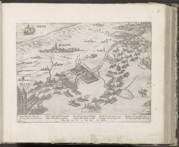
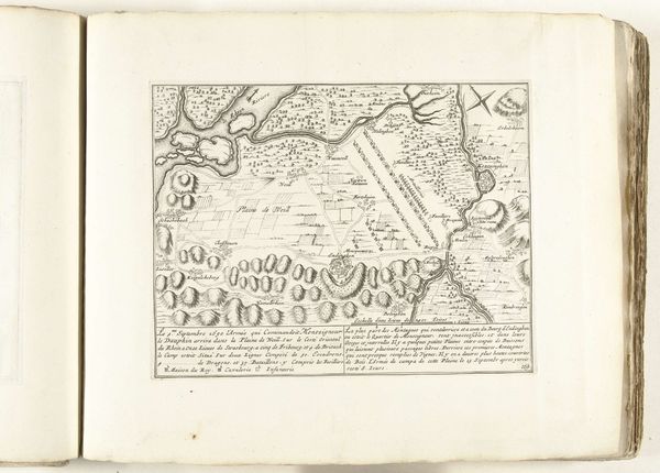
This detailed map, "Het Franse leger op de Plaine de Weill," was made in 1690 by an anonymous artist, offering a bird's-eye view of the French army positioned on the Plaine de Weill. Reflecting the era's emphasis on military strategy and geographical precision, this work provides insight into the maneuvers and encampments of Louis XIV's forces during a period of intense European conflict. Its creation speaks to the intersection of cartography and power, highlighting how maps were not merely tools for navigation but instruments of political and military control. The map invites us to consider the human scale of conflict, imagining the lives of soldiers and civilians caught in the theatre of war, and how their identities and experiences were shaped by these events. It serves as a reminder of the complex relationships between land, power, and identity, and the ways in which these dynamics continue to shape our world.
Comments
No comments
Be the first to comment and join the conversation on the ultimate creative platform.
More like this