print, engraving
# print
#
cityscape
#
engraving
Dimensions: height 176 mm, width 216 mm
Copyright: Rijks Museum: Open Domain
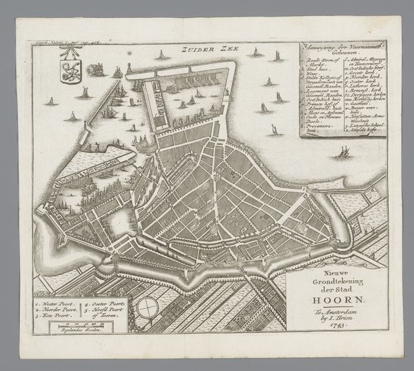
This is an anonymous map of Dordrecht, made using etching. Historical maps were more than just geographical tools; they were statements of power, reflecting the complex social structures of their time. This plattegrond offers a bird's-eye view of the city and also serves as a form of visual inventory, cataloging significant buildings and spaces. Consider who had access to this map and what their intentions might be. The detailed portrayal of churches and schools suggests the importance of religious and civic institutions in shaping community identity. Meanwhile, the presence of ships and waterways reminds us of Dordrecht’s role in trade and commerce, activities that deeply impacted the lives of both the privileged and the marginalized. What stories does this map leave untold? Whose perspectives are missing from this carefully constructed representation of urban life?
Comments
No comments
Be the first to comment and join the conversation on the ultimate creative platform.
More like this