drawing, print, ink, engraving
#
drawing
#
baroque
#
dutch-golden-age
# print
#
ink
#
geometric
#
cityscape
#
engraving
Dimensions: height 193 mm, width 259 mm
Copyright: Rijks Museum: Open Domain
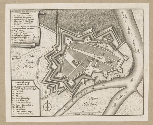
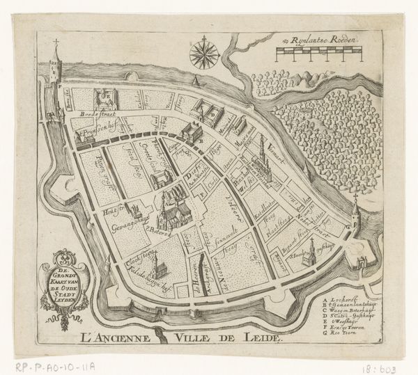
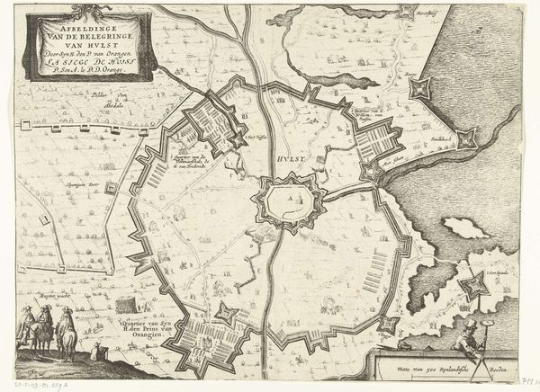
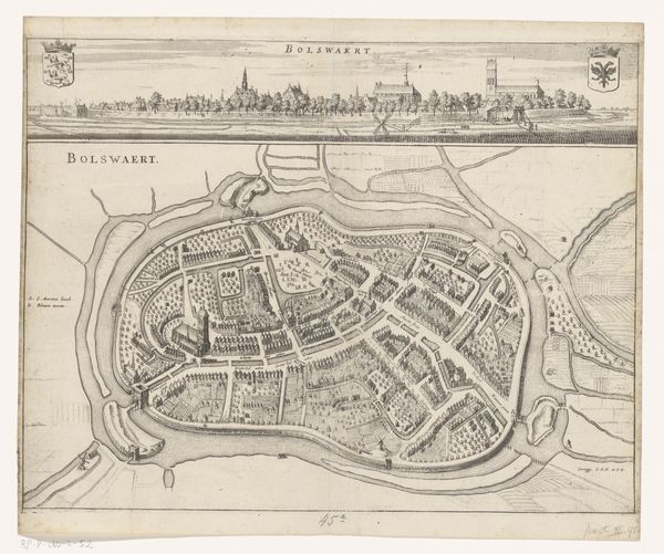
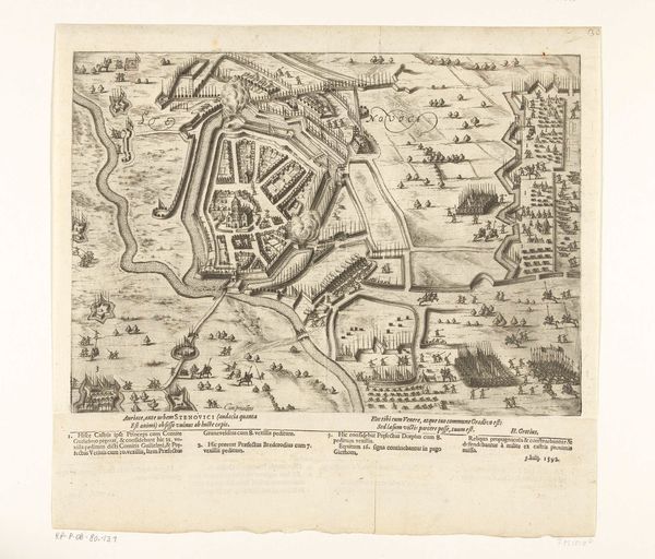
Curator: Gaspar Bouttats's engraving from 1672, "Plattegrond van Utrecht, veroverd door de Fransen in 1672," captures a pivotal moment in the city's history. It's a detailed city plan made with ink, currently residing in the Rijksmuseum's collection. What strikes you initially? Editor: It’s a striking illustration that evokes an odd blend of precision and impending doom. The geometrical shapes neatly compartmentalize space, but also serve to display fortification. You can feel the weight of military occupation, that must have affected daily life in Utrecht during that period. Curator: Absolutely. The engraving provides more than just geographic accuracy; it visualizes power dynamics and urban tension. Notice how Bouttats highlights key strategic points through a system of enumeration: churches, fortified walls, significant buildings—it’s a city rendered as a battleground. Editor: Yes, and I can’t help but think about the labour and materials that went into creating it. Engraving demanded painstaking skill and patience. The printing and dissemination would have required not just expertise but access to the channels of communication. Who commissioned this, I wonder, and how was it distributed? Curator: That's key—understanding this artwork as a product tied to its time. Such city plans often served propaganda purposes, celebrating military victories and reminding inhabitants of the new regime’s authority. The Golden Age intertwined artistic expression with commerce and power, always involving an intended viewership. Editor: So the materiality speaks of power and control, but it also reflects the labor of Dutch artisans, who were part of the social milieu within and without the landscape represented. Every stroke, every line is the result of learned labor that existed and made it exist. Fascinating to see how it captures social meaning of Dutch materiality. Curator: It's compelling to ponder how inhabitants of Utrecht reacted upon seeing their home reduced to a set of tactical diagrams! Did it inspire fear, or did it simply solidify the occupation of Utrecht within a framework of collective acceptance? Editor: These layers remind me to approach historical materials like this with curiosity beyond traditional connoisseurship. I leave wondering about the implications of how resources and labour were deployed. Curator: I agree entirely. It's important not to shy away from asking probing questions, especially concerning historical narratives that still shape the very world in which we reside today.
Comments
No comments
Be the first to comment and join the conversation on the ultimate creative platform.
More like this