drawing, print, etching, engraving
#
drawing
# print
#
etching
#
etching
#
11_renaissance
#
cityscape
#
engraving
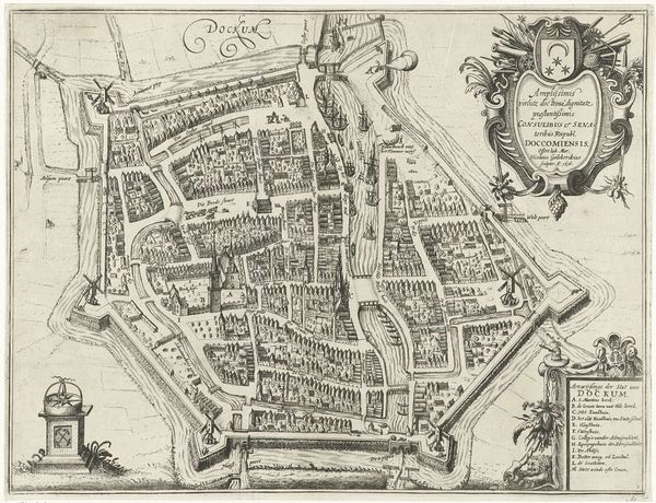
Dimensions: height 363 mm, width 458 mm
Copyright: Rijks Museum: Open Domain
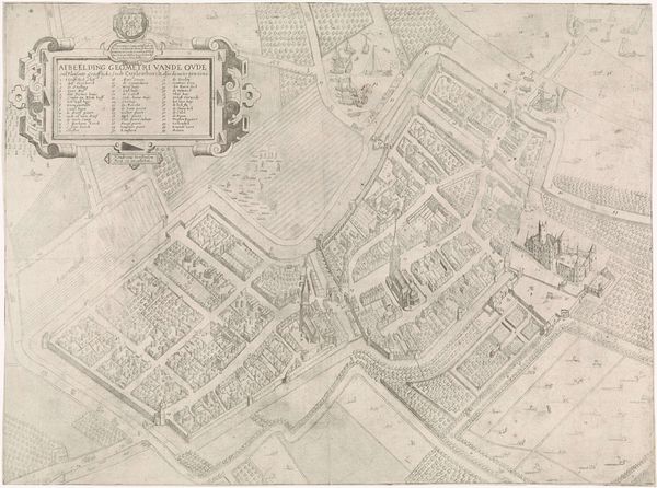
Pieter Bast created this map of Franeker in 1598 using etching. Maps like these served a vital purpose in early modern Europe, reflecting a culture deeply concerned with order, control, and the strategic importance of urban centers. Franeker, a city in the province of Friesland, in the Netherlands, was at the time more than just a point on the map; it was a hub of intellectual and political activity. In 1585, the University of Franeker was founded, becoming a key center of Protestant learning, which made accurate mapping a tool for governance and defense during the Dutch Revolt against Spanish rule. Bast's detailed rendering goes beyond mere topography, subtly asserting the power and influence of Franeker as a Protestant stronghold. To understand this image fully, one needs to explore archives, historical society records, and period documents, which all provide insight into the complex interplay of art, politics, and society in the early modern Netherlands.
Comments
No comments
Be the first to comment and join the conversation on the ultimate creative platform.
More like this