drawing, etching, ink
#
drawing
#
aged paper
#
dutch-golden-age
#
etching
#
landscape
#
etching
#
ink
#
warm toned green
Dimensions: height 510 mm, width 724 mm
Copyright: Rijks Museum: Open Domain
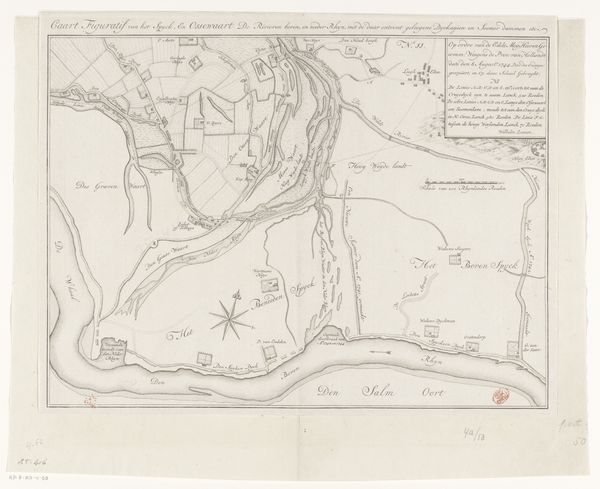
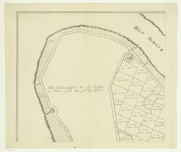
This is Maurits Walraven's map of the island of Urk. While we can’t say exactly when it was made, its rendering in pen, ink, and watercolor points to a time before the rise of industrial printing. This map offers us insights into the cultural and economic landscape of the Netherlands, a country where land and water have always been in contention. Note the detailed inscriptions concerning land measurements and the emphasis on the island’s coastal defense structures. This wasn’t just an exercise in geographical representation; it was a document tied to land use, property rights, and strategic planning. The detailed rendering also reflects the institutional and political power of the Dutch Republic which was a major maritime and economic power in the 17th and 18th centuries. To fully understand the map's significance, we would need to delve into local archives, and compare it with similar documents. This would help us understand its specific purpose and how it might have been used to shape perceptions and policies.
Comments
No comments
Be the first to comment and join the conversation on the ultimate creative platform.
More like this