print, engraving
#
dutch-golden-age
# print
#
landscape
#
geometric
#
cityscape
#
engraving
Dimensions: height 470 mm, width 582 mm
Copyright: Rijks Museum: Open Domain
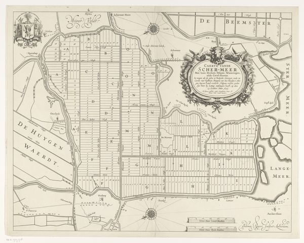
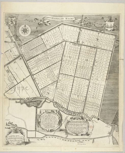
Curator: This engraving, titled "Verkaveling van de Zijpepolder, 1597," dates back to about 1600 and is currently held in the collection of the Rijksmuseum. It was created by Baptista van Doetechum. Editor: Immediately, I am struck by the sheer order of this composition. The precision is quite amazing and it feels like a premonition of modern urban planning and design, albeit from a much earlier period. Curator: Yes, its geometrical quality is undeniable, dictating the use of space by strict structural forms. This work provides a unique view of a Dutch Golden Age landscape that has been shaped through human interaction. Doetechum's lines are distinct, using an engraving medium to capture an artificial construction as subject. Editor: True. It also speaks volumes about power, land ownership, and control. Consider how the act of dividing and mapping plots transformed this landscape—making it accessible, while also excluding those without a land claim. I think the organization here is an indication of the way societal forces reshape the earth to meet the goals of some people, while often displacing other forms of living, of inhabitants, and uses. Curator: Absolutely. Structurally, though, let’s focus on the arrangement; observe how the land divisions are mapped to organize social elements of the space depicted and, too, note the use of various registers to incorporate information through text and graphics. Semiotically, the lines work together to convey very particular social data. Editor: Agreed. And while the strict linearity defines this work’s subject matter on one level, other information such as location names and keys contextualize how this space exists for social, economic and even political frameworks that influence identity and movement. It’s a reminder of cartography’s political nature and the power it has to establish particular socio-cultural realities, even ones imposed through colonization. Curator: That is an excellent point, the contextual readings are essential to the complete vision this artwork creates. It definitely opens channels into a fuller understanding beyond its composition! Editor: It is such a revealing piece when we think about these concepts in relationship with contemporary social constructs and how art echoes reality!
Comments
No comments
Be the first to comment and join the conversation on the ultimate creative platform.
More like this