drawing, print, paper, ink, architecture
drawing
landscape
paper
ink
architectural drawing
architecture
Dimensions: height 517 mm, width 523 mm
Copyright: Rijks Museum: Open Domain
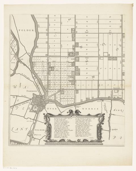
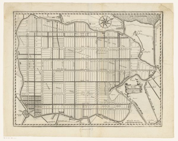
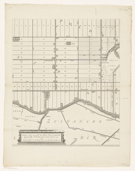
Jan Baptist Jongelinx created this map of the polders of Oorderen, Wilmarsdonk and Ordam, which offers a glimpse into the 17th-century landscape of land management and social structure. This map is more than just a geographical document; it represents a specific intersection of human intervention and environmental control in the region. It reflects the economic and social dynamics of the time, where land ownership and agricultural productivity were central to power and prosperity. It provides a visual inventory of land use, marking out individual plots and areas designated for various purposes. Consider the labor required to transform these marshlands into arable land. This endeavor involved complex systems of canals and dikes managed through community collaboration and enforced by social hierarchies. Here we can trace how the community shaped the land, and how the land shaped the community. The map is a testament to the enduring human desire to not only inhabit, but to also manage the natural world.
Comments
No comments
Be the first to comment and join the conversation on the ultimate creative platform.