drawing, print
#
architectural sketch
#
storyboard
#
drawing
#
building study
#
dutch-golden-age
# print
#
architectural diagram
#
architectural plan
#
landscape
#
geometric
#
architectural section drawing
#
architectural drawing
#
architecture drawing
#
architectural proposal
#
storyboard and sketchbook work
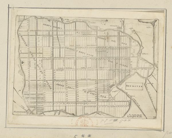
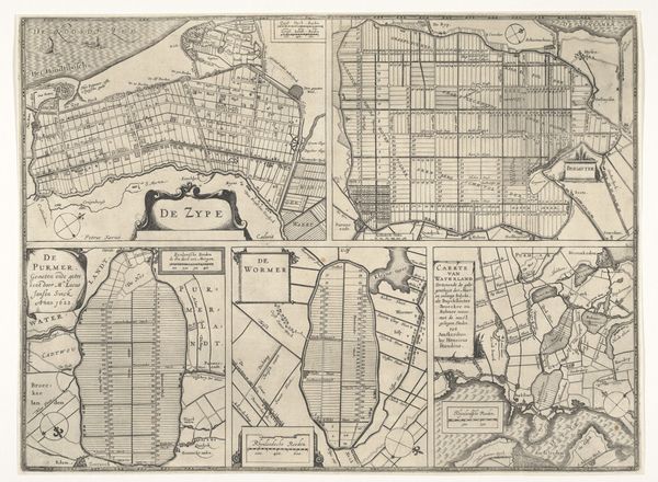
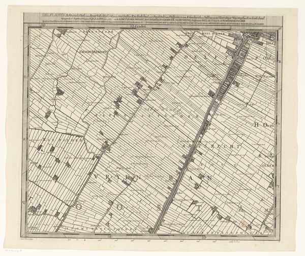
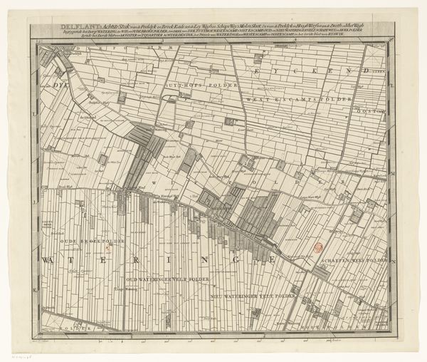
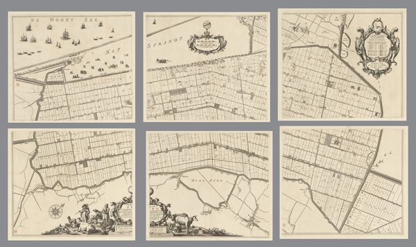
Dimensions: height 922 mm, width 1170 mm
Copyright: Rijks Museum: Open Domain
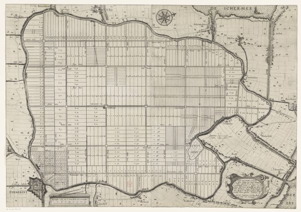
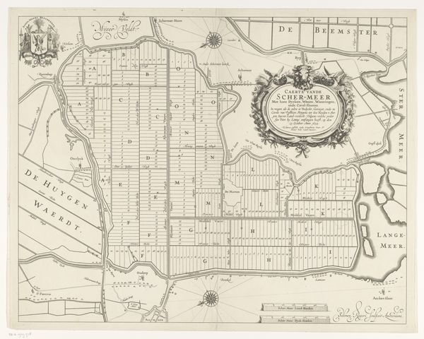
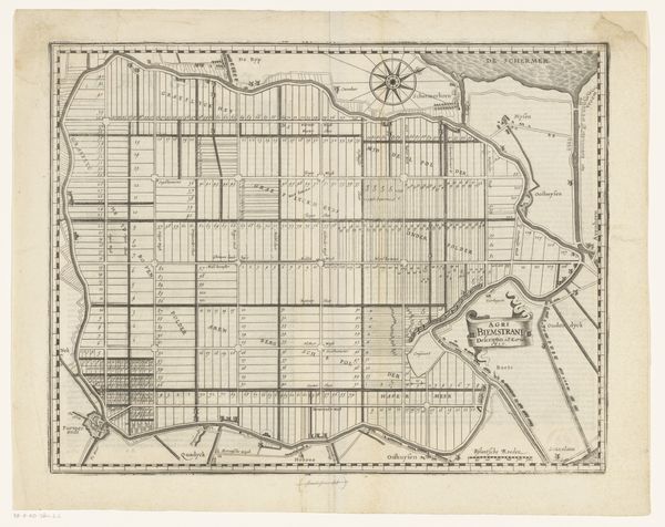
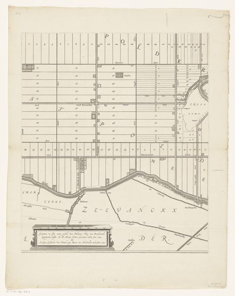
Curator: What a striking, almost haunting visual! Six panels forming, essentially, a fragmented map. Editor: Indeed. Here we have "Kaart van de Beemster, bestaande uit zes delen," or "Map of the Beemster, consisting of six parts," created sometime between 1644 and 1685 by Daniël van Breen. It's a print, likely an engraving. Notice how it's segmented? It evokes a feeling of both precision and...brokenness, somehow. Curator: It's that rigid geometry against the subtle distortions of the lines that gets me. Like trying to impose order on something inherently fluid, or even chaotic, perhaps a feeling related to claiming land back from the sea. I’m captivated by the grid, this ordered landscape. It's so...unnatural. Yet, so intentional. Editor: That intentionality speaks volumes. Maps are, at their core, acts of claiming. The very act of naming a place, of delineating its boundaries, is an assertion of power. The severe geometry mirrors the imposition of human will, that very Dutch story of land reclamation and rationalization. Those grids are about control and transformation. Curator: Yes! Think about what the grid has meant throughout history; from city planning to psychological spaces in art, it acts as a framework for thinking. You mentioned the idea of a very Dutch story. There's something melancholic about seeing this pursuit of absolute order represented in the marshy realities it symbolizes. Editor: Absolutely, I think it makes visible the constant negotiation between humankind and nature. And there’s a vulnerability here too, maybe. Maps age. Boundaries shift, empires crumble, and names fade, leaving these intricate webs as ghostly echoes of past ambitions. The Beemster still exists of course but our perception and use of it changes with every generation. Curator: It leaves me pondering the fragility of our constructions, both literal and conceptual. An architectural diagram that tells so much more of a story about control and shifting realities... it’s lovely and haunting all at once. Editor: For me, it underlines the transient nature of these cartographic symbols, their capacity to transcend mere documentation and reflect deeper truths about human ambition and the ever-changing world we inhabit.
Comments
No comments
Be the first to comment and join the conversation on the ultimate creative platform.
More like this