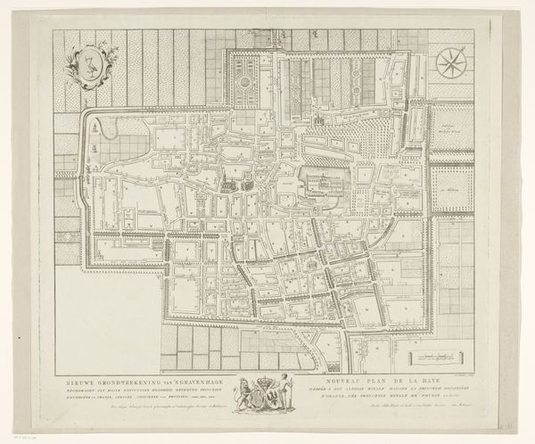
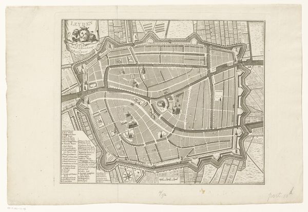
print, engraving
geometric
cityscape
history-painting
engraving
Dimensions: height 318 mm, width 425 mm
Copyright: Rijks Museum: Open Domain
Editor: So this is "Plattegrond van Den Haag," an engraving from 1755 by Iven Besoet. At first glance, it's just a meticulously rendered city map, very detailed. I’m curious about the symbolic elements—that crane, for instance— and how the map functions beyond mere geography. What do you see in this piece? Curator: Maps aren’t just about physical space; they reflect a culture's understanding of itself, its priorities. Consider the crane: what might that evoke for someone in the 18th century viewing this image? Bird symbology runs deep in Dutch consciousness—fidelity, vigilance, hope. And placing that on a city plan? It's asserting those values onto the very streets. The "Explication" or the labels also tell a story of governance. Editor: That's fascinating. It never occurred to me the act of labeling, even key landmarks, can tell that kind of story about power. Curator: Precisely! Ask yourself what structures are featured and prioritized? Does this represent the organic growth or planned order, what is imposed and what is intuitive, a power center's intentions? Also, the geometric grid of the streets compared to more 'organic' shapes may represent a tension. Are there certain family crests there that assert more significance, or areas where that family had great authority? All of this represents emotional connection, cultural memory. What else grabs your attention? Editor: The compass rose is quite prominent. And there is French alongside Dutch text. Perhaps the city aimed to present itself to an international audience? Curator: That bi-lingual choice, yes, suggests a certain status anxiety perhaps, or diplomatic aspiration, an outward presentation to Europe that says we are current, aware. Remember too, maps are made for specific eyes, to reinforce certain narratives. Editor: I never looked at a map and considered so much embedded meaning! Thanks for that insight. Curator: And thank you; I will carry your ideas of cartography forward with me too.
Comments
No comments
Be the first to comment and join the conversation on the ultimate creative platform.