print, engraving
#
baroque
# print
#
old engraving style
#
landscape
#
geometric
#
line
#
cityscape
#
engraving
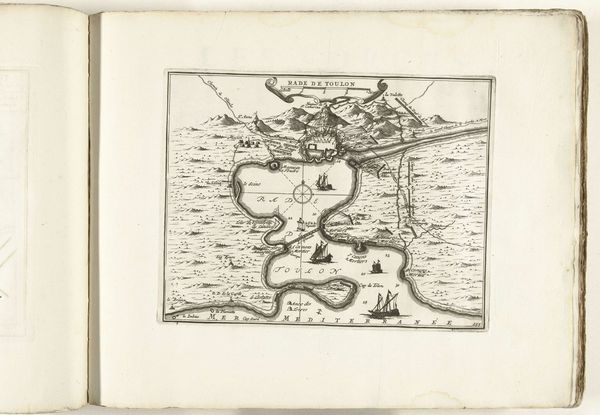
Dimensions: height 214 mm, width 275 mm
Copyright: Rijks Museum: Open Domain
This is an anonymous map of Toulon, made in 1726. At this time, cartography was used as a tool of empire, which this map exemplifies. Notice how the depiction of Toulon serves the strategic and military interests of the French state. The detailed rendering of the harbor and coastline is less about geographic accuracy, and more a projection of power and control, reflecting the complex entanglements of trade, naval power, and colonial expansion. This reflects how the creation and dissemination of maps were influenced by the dominant political and economic structures. Consider the unacknowledged labor and knowledge of the local populations whose lands and waters are being mapped. These maps often erased or misrepresented the presence and perspectives of indigenous communities, thereby serving to legitimize colonial claims and resource extraction. Consider how the map may have inspired both a sense of national pride and a desire for further exploration and conquest, reflecting the emotional and ideological power that cartography held during this era.
Comments
No comments
Be the first to comment and join the conversation on the ultimate creative platform.
More like this