About this artwork
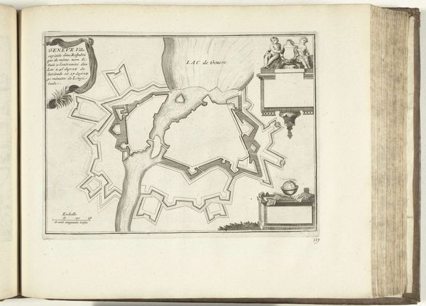
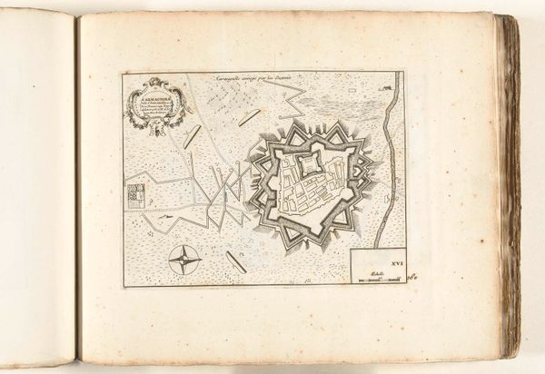
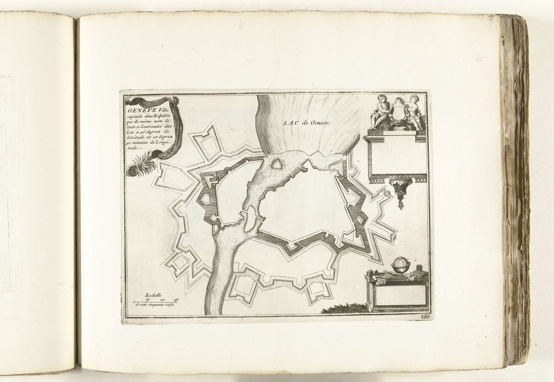
This is an anonymous map of Geneva, made around 1702. It's a reminder of the intense geopolitical competition that marked Europe at the turn of the 18th century. Seen here, Geneva is not simply a place, but a strategic stronghold. The city is depicted as a fortress, its boundaries shaped by defensive walls. Notice how the map emphasizes the city’s fortifications, reflecting the constant threat of invasion and the need for protection. This image reflects a society structured around military defense and political maneuvering. The map also evokes questions of identity and belonging. Who was included within those walls, and who was excluded? How did the city's defenses shape the lives of its inhabitants and their interactions with the outside world? Ultimately, this map is more than a geographical document; it's a window into a world defined by conflict, power, and the ever-present need for security. It reminds us of the human stories embedded in the landscape and the lasting impact of historical forces on our sense of place.
Artwork details
- Medium
- drawing, print, paper, ink, engraving
- Dimensions
- height 212 mm, width 285 mm
- Location
- Rijksmuseum
- Copyright
- Rijks Museum: Open Domain
Tags
Comments
Share your thoughts
About this artwork
This is an anonymous map of Geneva, made around 1702. It's a reminder of the intense geopolitical competition that marked Europe at the turn of the 18th century. Seen here, Geneva is not simply a place, but a strategic stronghold. The city is depicted as a fortress, its boundaries shaped by defensive walls. Notice how the map emphasizes the city’s fortifications, reflecting the constant threat of invasion and the need for protection. This image reflects a society structured around military defense and political maneuvering. The map also evokes questions of identity and belonging. Who was included within those walls, and who was excluded? How did the city's defenses shape the lives of its inhabitants and their interactions with the outside world? Ultimately, this map is more than a geographical document; it's a window into a world defined by conflict, power, and the ever-present need for security. It reminds us of the human stories embedded in the landscape and the lasting impact of historical forces on our sense of place.
Comments
Share your thoughts