drawing, print, paper, ink, engraving
#
drawing
#
baroque
# print
#
pen sketch
#
sketch book
#
paper
#
personal sketchbook
#
ink
#
sketchwork
#
ink drawing experimentation
#
geometric
#
pen-ink sketch
#
line
#
pen work
#
sketchbook drawing
#
cityscape
#
storyboard and sketchbook work
#
sketchbook art
#
engraving
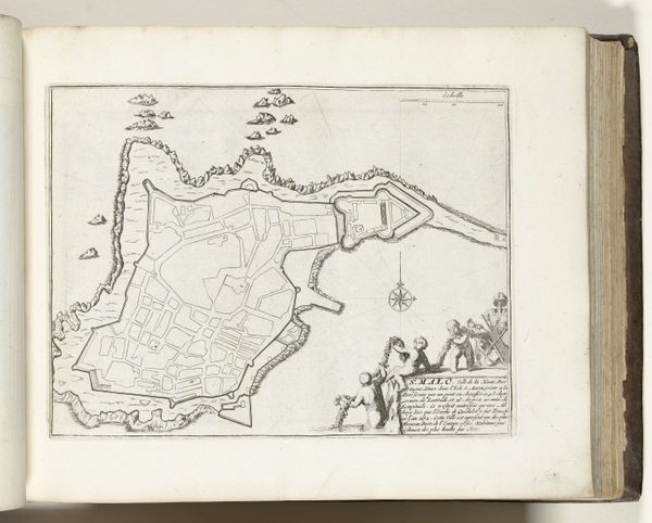
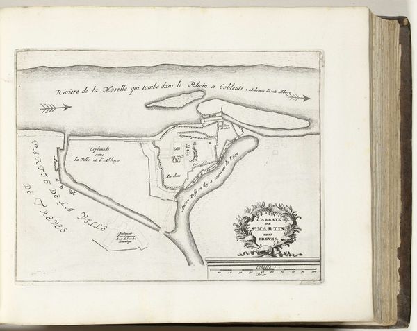
Dimensions: height 213 mm, width 284 mm
Copyright: Rijks Museum: Open Domain
This is an anonymous engraving, circa 1693 to 1695, depicting a map of Nice. The composition, rendered in precise lines, offers a bird's-eye view, abstracting the city into a structured arrangement of forms. The stark contrast between the built environment and natural features highlights a tension between order and organic growth. Notice how the geometric shapes of the fortifications and urban blocks contrast with the undulating lines representing the landscape. The artist employs a semiotic system here, where lines and shapes function as signs, communicating strategic information about the city's layout and defenses. The map challenges fixed meanings, inviting us to consider how space is perceived and controlled. This artwork doesn't merely represent a place; it embodies power structures through its calculated representation. The visual organization invites us to reflect on how cartography can reflect both aesthetic and ideological concerns.
Comments
No comments
Be the first to comment and join the conversation on the ultimate creative platform.
More like this