drawing, paper, ink, pencil
#
drawing
#
quirky sketch
#
baroque
#
pen sketch
#
sketch book
#
perspective
#
paper
#
personal sketchbook
#
ink
#
sketchwork
#
geometric
#
pen-ink sketch
#
pencil
#
pen work
#
sketchbook drawing
#
cityscape
#
storyboard and sketchbook work
#
sketchbook art
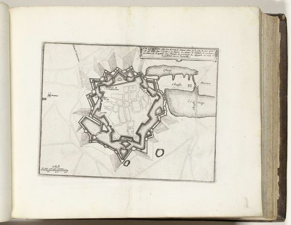
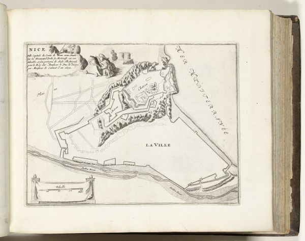
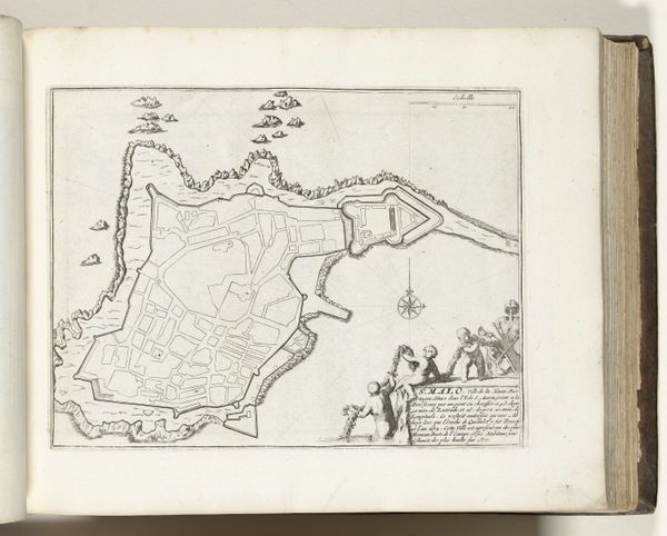
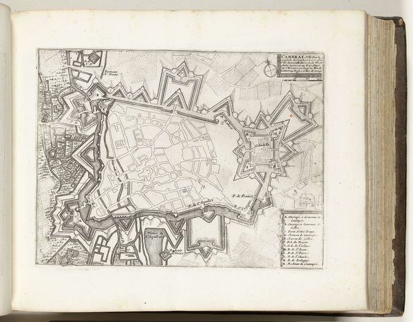
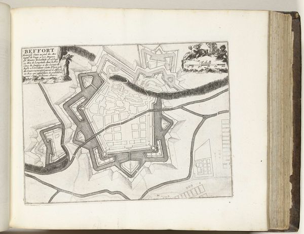
Dimensions: height 205 mm, width 282 mm
Copyright: Rijks Museum: Open Domain
Editor: Here we have a fascinating pen and ink drawing, "Plattegrond van Homburg," dating from around 1693-1695 by an anonymous artist, housed here at the Rijksmuseum. The detail is amazing. The lines feel so precise and intentional. How do you interpret this kind of work, considering its historical context? Curator: It’s crucial to recognize that this isn't just a drawing; it’s a deliberate representation of power and control. These kinds of plans, prevalent in the late 17th century, functioned less as objective records and more as instruments of strategic communication. How do you think a ruler might have used this sort of image? Editor: I suppose to strategize defenses, or perhaps even for propaganda purposes? Curator: Precisely! The clean lines, geometric precision, and elevated perspective create an idealized vision of Homburg. It portrays order and strength, intended to project authority, and bolster the morale of the troops but also to strike fear in potential enemies. The Baroque period saw the rise of absolutist states, and art became a tool to legitimize their power. It is intriguing how this "sketch" enters into a cultural program. Editor: That makes perfect sense. So the drawing is less about accurate depiction and more about communicating a message? Curator: Exactly. It’s about controlling the narrative, using art to project dominance in a time of frequent conflict. Also notice the script near the city, it may have named and categorized it for record-keeping. Editor: It's amazing to consider the multiple layers of meaning embedded in what seems like a simple city plan. Curator: Yes, examining it through the lens of cultural and institutional history allows us to see beyond the aesthetic and understand its role in the politics of the era. Now, the purpose has been served and we can consider the image as a unique look into the history of the location and the moment.
Comments
No comments
Be the first to comment and join the conversation on the ultimate creative platform.
More like this