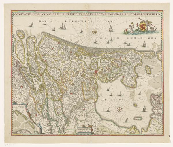
graphic-art, print, engraving
#
graphic-art
#
baroque
#
dutch-golden-age
# print
#
landscape
#
engraving
Dimensions: height 396 mm, width 512 mm
Copyright: Rijks Museum: Open Domain
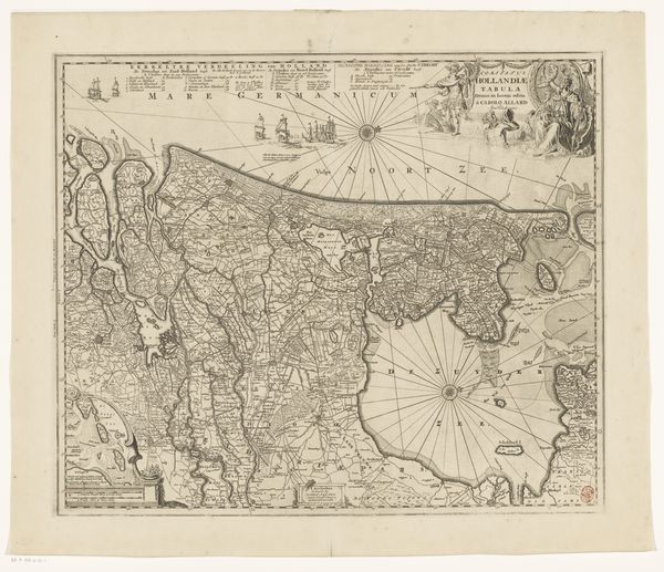
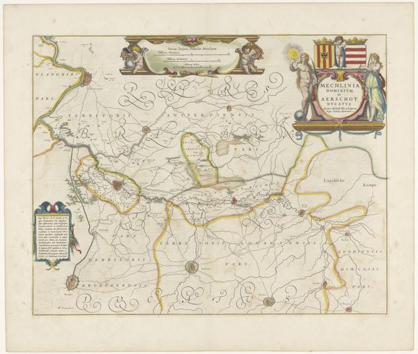
Curator: This engraving from the Dutch Golden Age, created between 1629 and 1638, is Salomon Rogiers's "Kaart van het graafschap Holland" – or "Map of the County of Holland." Editor: Immediately, the most striking element to me is the geometric precision within the organic form of the coastline. The density of lines suggests meticulous labor. Curator: Indeed. The work provides more than mere geographical data; it articulates claims about political power. We see Holland during the early stages of its transformation from a region ravaged by the Eighty Years' War to the dominant province within the Dutch Republic. Consider how these visual representations solidified Dutch identity and claims to land during a period of intense national formation. Editor: That reminds me, look at the symbols sprinkled throughout—the heraldic devices and small ships denote commerce and sovereignty. And there's an interesting duality between the almost scientific precision of the map's grid system and the embellished baroque cartouches and flourishes. How do these elements relate? Curator: Exactly! The map's purpose goes beyond simple wayfinding; it projects power and a burgeoning mercantile identity. Rogiers carefully renders the landscape, but more profoundly, he asserts dominion over it at a crucial juncture. It also brings the impact of cartography into sharper focus—these maps directly influence economic, military, and ultimately, societal strategies. Editor: I see now—it’s not just about the place, but about the assertion of the self in relation to that place. It presents Holland as knowable, organized, and ripe for economic exploration. I particularly note the intricate network of waterways depicted – the trade routes, and arteries of Dutch commerce during that period. Curator: Yes. These waterlines denote a network connecting communities through complex negotiations that also created conflicts of economic gain with profound implications on colonial expansion and class structures within Holland itself. Editor: Thinking about this map, I can see how the blend of observation, geometry, and symbolic language crafts a powerful narrative about control and belonging. Curator: Ultimately, Rogiers's “Kaart van het graafschap Holland” stands as a powerful synthesis of geographic fact and ideological purpose during the dawn of Dutch ascendancy.
Comments
No comments
Be the first to comment and join the conversation on the ultimate creative platform.
More like this