About this artwork
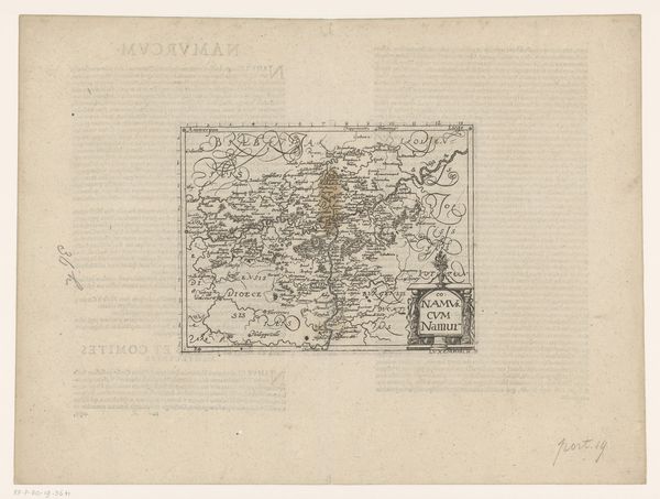
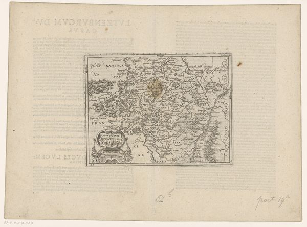
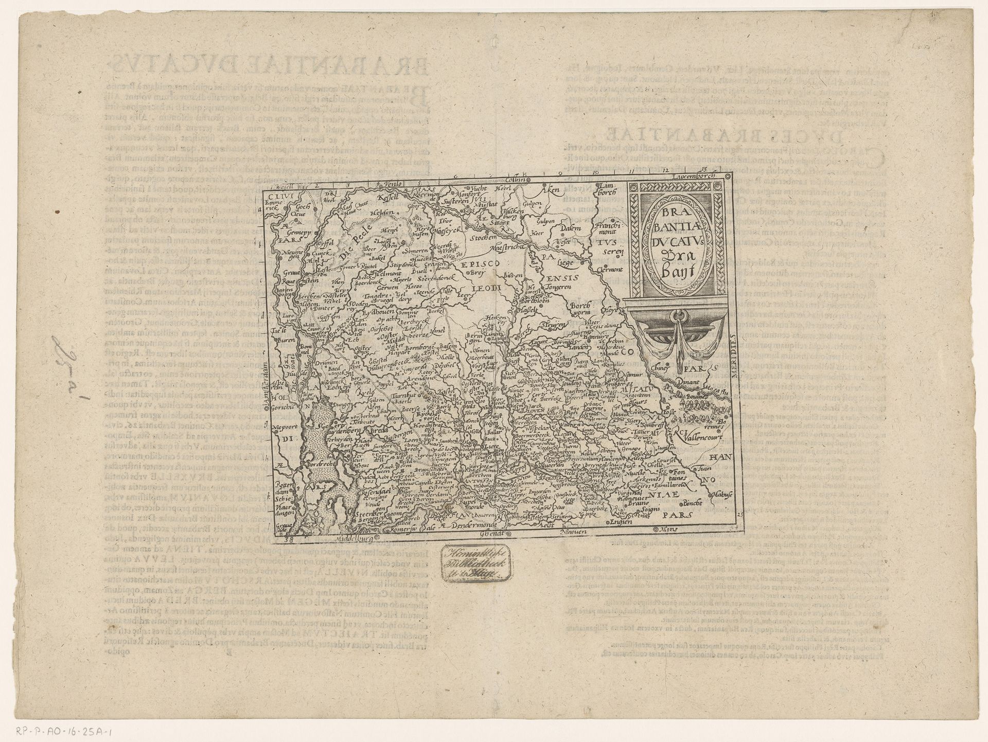
Curator: This is Frans Hogenberg’s "Kaart van Brabant," made between 1579 and 1602. It’s currently held here at the Rijksmuseum. An engraved print. Editor: Immediately, the density of detail strikes me. It feels like a woven tapestry of place names and borders, painstakingly rendered. The line work gives it an austere but also weirdly compelling atmosphere. Curator: It's more than just a geographical record; it's a visual testament to Brabant's significance during the period of the Dutch Revolt. Hogenberg’s maps were key tools of political awareness and communication. I'd imagine them being actively produced and reproduced in great quantities to feed information. Editor: That really highlights the human element, doesn’t it? We’re talking about someone carefully carving each line into the plate. All those tiny marks accumulate into something so informative. There's so much invisible labour in it. You know, consider what materials he used, how those metals, papers, and inks had globalized colonial routes that shaped artistic possibilities. Curator: Precisely! This particular rendering embodies a certain northern Renaissance sensibility, focused as it is on accurate, even scientific observation. But look closer, and there are flourishes. Consider the title cartouche, like an assertive stage-setting amidst turmoil. Editor: And to think that these maps would circulate in diverse printed formats that are consumed by rulers to radicals; there must have been an intimate connection to knowledge about land, property, even governance. This kind of work makes you rethink the social function of landscape imagery at the dawn of capitalism, huh? Curator: Absolutely. And for me, reflecting on its enduring artistic power, "Kaart van Brabant" remains so thought-provoking. I keep thinking how that era reshaped our mental maps – geographically, politically, culturally. Editor: Indeed, what a remarkable encounter—unfolding like the creases on an aged document, revealing historical contexts to illuminate an experience that echoes powerfully through time.
Artwork details
- Medium
- print, engraving
- Dimensions
- height 148 mm, width 194 mm
- Location
- Rijksmuseum
- Copyright
- Rijks Museum: Open Domain
Tags
Comments
Share your thoughts
About this artwork
Curator: This is Frans Hogenberg’s "Kaart van Brabant," made between 1579 and 1602. It’s currently held here at the Rijksmuseum. An engraved print. Editor: Immediately, the density of detail strikes me. It feels like a woven tapestry of place names and borders, painstakingly rendered. The line work gives it an austere but also weirdly compelling atmosphere. Curator: It's more than just a geographical record; it's a visual testament to Brabant's significance during the period of the Dutch Revolt. Hogenberg’s maps were key tools of political awareness and communication. I'd imagine them being actively produced and reproduced in great quantities to feed information. Editor: That really highlights the human element, doesn’t it? We’re talking about someone carefully carving each line into the plate. All those tiny marks accumulate into something so informative. There's so much invisible labour in it. You know, consider what materials he used, how those metals, papers, and inks had globalized colonial routes that shaped artistic possibilities. Curator: Precisely! This particular rendering embodies a certain northern Renaissance sensibility, focused as it is on accurate, even scientific observation. But look closer, and there are flourishes. Consider the title cartouche, like an assertive stage-setting amidst turmoil. Editor: And to think that these maps would circulate in diverse printed formats that are consumed by rulers to radicals; there must have been an intimate connection to knowledge about land, property, even governance. This kind of work makes you rethink the social function of landscape imagery at the dawn of capitalism, huh? Curator: Absolutely. And for me, reflecting on its enduring artistic power, "Kaart van Brabant" remains so thought-provoking. I keep thinking how that era reshaped our mental maps – geographically, politically, culturally. Editor: Indeed, what a remarkable encounter—unfolding like the creases on an aged document, revealing historical contexts to illuminate an experience that echoes powerfully through time.
Comments
Share your thoughts