drawing, print, paper, watercolor
#
drawing
# print
#
landscape
#
paper
#
watercolor
#
coloured pencil
#
geometric
#
cityscape
#
watercolour illustration
#
watercolor
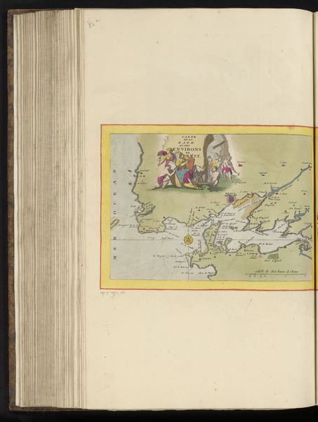
Dimensions: height 208 mm, width 269 mm, height 532 mm, width 320 mm
Copyright: Rijks Museum: Open Domain
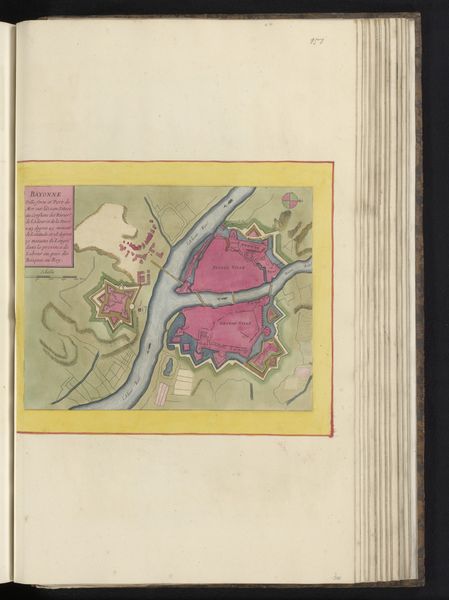
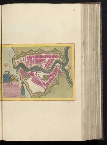
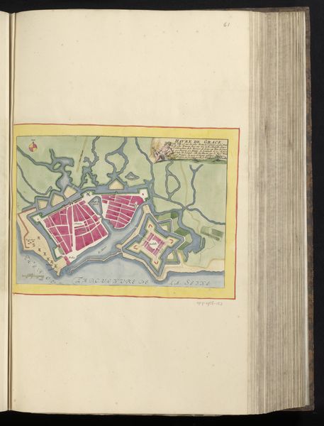
Editor: This is an anonymous map, titled "Vestingplattegrond van La Rochelle," dating from around 1690 to 1700. It’s a watercolor and ink drawing on paper. What jumps out to me is how geometric and almost playful it looks, despite depicting what was surely a place of conflict and strategic importance. How do you read this particular visual representation? Curator: This isn’t just a map; it’s a visual encoding of power, memory, and aspiration. Notice how the city is presented, almost gem-like with its colored sections – pink, green, outlined in dark ink, resembling fortifications. What do these stylized choices evoke for you? Editor: Well, the colors are pretty, so it initially gives a sense of prosperity and order. But I imagine the imposing fortress design must have been perceived very differently by the people inside, compared to those outside. Curator: Exactly! The geometric layout, with its star-shaped fort and elaborate water defenses, isn’t merely descriptive. It’s symbolic. The geometry speaks of control, rational planning, and a vision of impregnability. These geometric shapes were themselves symbols understood within a larger political and social language. Can you see how such visual language creates a shared cultural understanding, solidifying social structures, influencing those who see it? Editor: I do. It makes me think about how we use maps today – not just for navigation but to project ideas about territory and identity. It is amazing how potent a seemingly neutral image can be. Curator: Precisely! Even practical images carry cultural weight, expressing ideas that extend far beyond its immediate purpose. This has been so insightful, to view maps as more than just practical drawings, and something filled with layers of intent and perspective.
Comments
No comments
Be the first to comment and join the conversation on the ultimate creative platform.
More like this