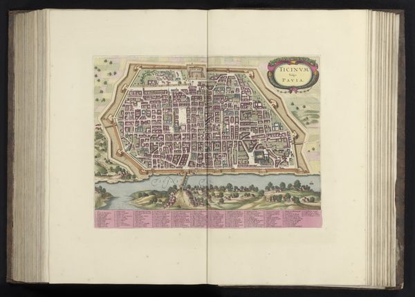
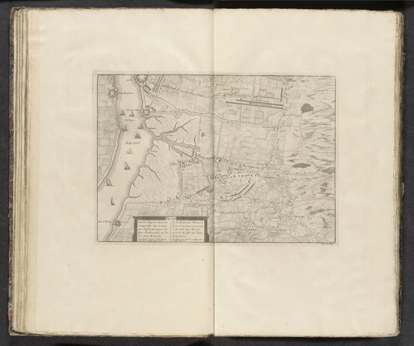
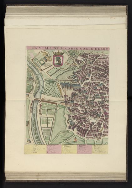
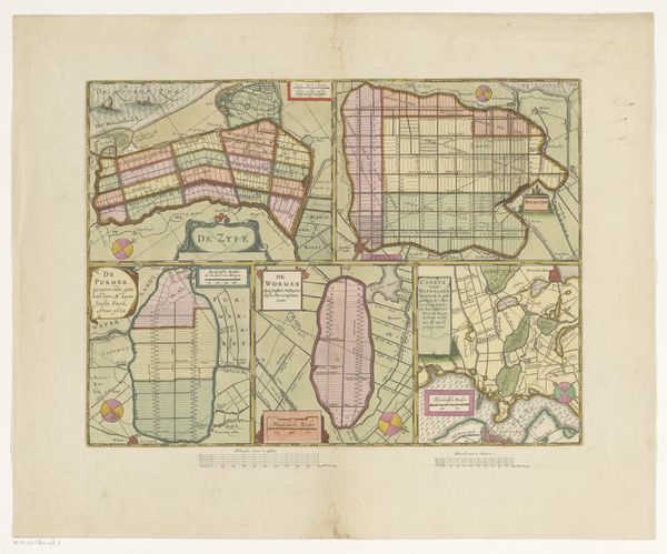
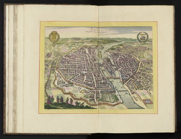
print, engraving
#
baroque
# print
#
landscape
#
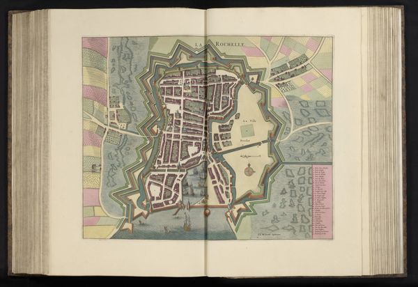
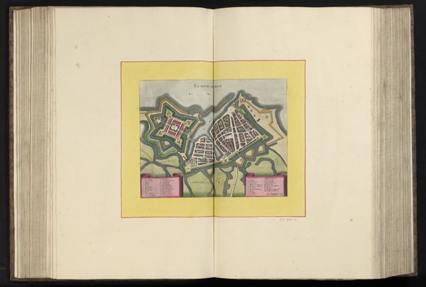
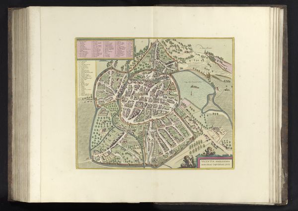
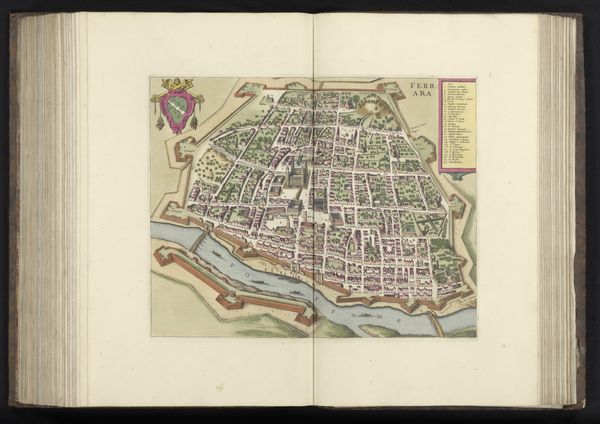
cityscape
#
engraving
Dimensions: height 286 mm, width 344 mm, height 532 mm, width 320 mm
Copyright: Rijks Museum: Open Domain
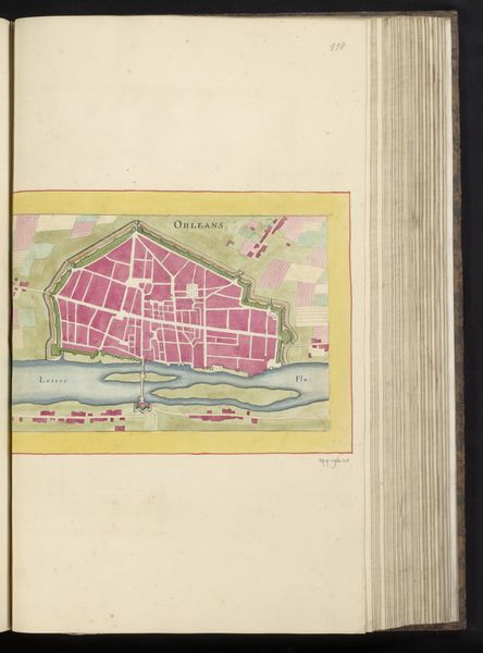
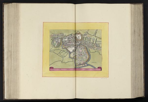
This is an anonymous, undated map of La Rochelle, likely created with ink and watercolor. The composition presents a bird's-eye view, neatly framed, evoking both scientific precision and aesthetic design. The warm yellow border contrasts with the intricate network of lines and shapes depicting the city’s layout, its architecture, and surrounding landscape. The formal structure of the map is fascinating. The city is enclosed by complex fortifications, which, when interpreted through a semiotic lens, reflect early modern Europe's obsession with defense and control. The map also represents an emerging scientific worldview, seeking to codify and control space through visual representation. Each line, color, and shape serves as a sign, contributing to a larger narrative about power, knowledge, and representation. Notice the tension between the order of the city's layout and the wild, organic shapes of the surrounding landscape, hinting at a struggle between human order and natural chaos. This map presents a vision of a world striving for order and comprehension. A vision that continues to evolve with each new viewing.
Comments
No comments
Be the first to comment and join the conversation on the ultimate creative platform.
More like this