1702 - 1703
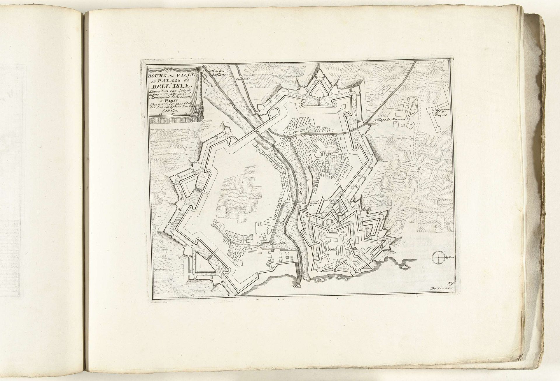
Plattegrond van Belle Ile, ca. 1702
Anonymous
@anonymousLocation
RijksmuseumListen to curator's interpretation
Curatorial notes
This is an anonymous drawing of Plattegrond van Belle-Île, made around 1702. Situated off the coast of Brittany, France, Belle-Île was a strategic location, often caught in the power struggles between France and England. This detailed map, with its emphasis on fortifications, speaks to the island's military significance. The star-shaped forts, rendered with precision, highlight the importance of defense in an era defined by colonial expansion and maritime dominance. In the early 18th century, maps weren't just geographical tools; they were instruments of power, reflecting a nation's ambition to control territories and trade routes. Consider the perspective of those who lived on Belle-Île. For them, this map would have represented not just their home, but also the ever-present threat of invasion and the imposition of foreign rule. It is a landscape of power, shaped by geopolitical forces.