drawing, paper, architecture
#
architectural sketch
#
drawing
#
aged paper
#
architectural diagram
#
architectural plan
#
paper
#
spread layout sheet
#
geometric
#
elevation plan
#
architectural section drawing
#
architectural drawing
#
architecture drawing
#
architectural proposal
#
cityscape
#
architecture
Dimensions: height 664 mm, width 970 mm
Copyright: Rijks Museum: Open Domain
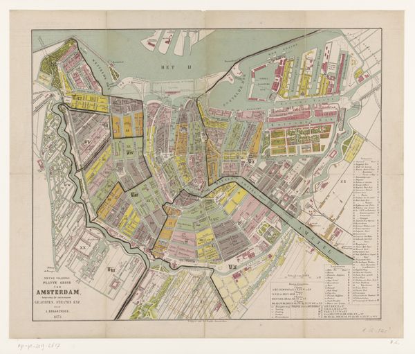
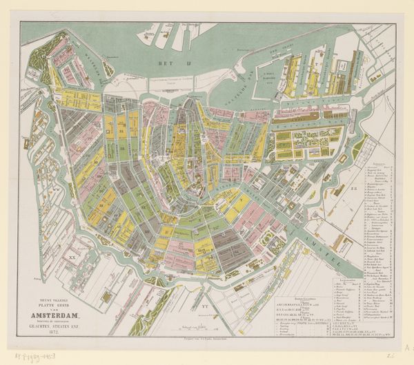
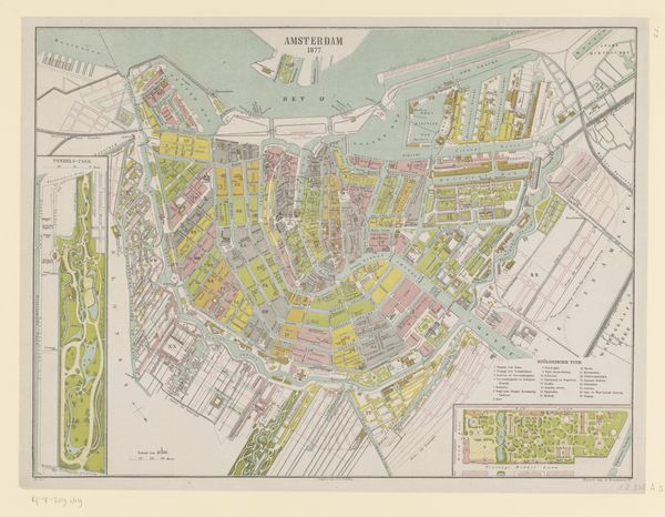
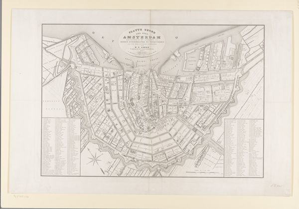
Editor: So, here we have Ruurt de Vries’s “Plattegrond van Amsterdam-Zuid” from 1873, a drawing on paper depicting a plan of Amsterdam South. It has a slightly eerie feel; like a ghost city because of the faded paper. What's your interpretation? Curator: This drawing gives us a peek into Amsterdam’s socio-spatial evolution. Look closely—what do you notice about the highlighted area, planned versus unplanned, in contrast to the organic form of the canals in the old center? The contrast illuminates power structures embedded in urban development. How did urban planning impact various communities differently? Editor: I see the sharp, regular grids of the proposed expansion as very different to the rest. The way it's separate kind of strikes me as an almost colonial vision, planning and taming wild land. Curator: Precisely! The grid system is not neutral; it represents an imposed order, linked to modernization and control. Think about who benefited from this planned expansion. Did it serve the needs of all residents, or did it marginalize certain groups? This piece also suggests looking critically at how cartography and planning shape our understanding and experience of urban spaces. It implicitly makes an argument about the relationship between social engineering and architecture, no? Editor: That’s a perspective I hadn't considered before. Now I'm looking at it with very different eyes, focusing on the communities it could have impacted and how some people benefit from the project and expansion when others maybe wouldn't have done. Curator: Exactly! Engaging with art like this challenges us to look at history from multiple viewpoints and to reflect on the social and political forces embedded in the built environment. It's important to understand the past to transform the present. Editor: I’ll definitely remember that moving forward. Thanks!
Comments
No comments
Be the first to comment and join the conversation on the ultimate creative platform.
More like this