About this artwork
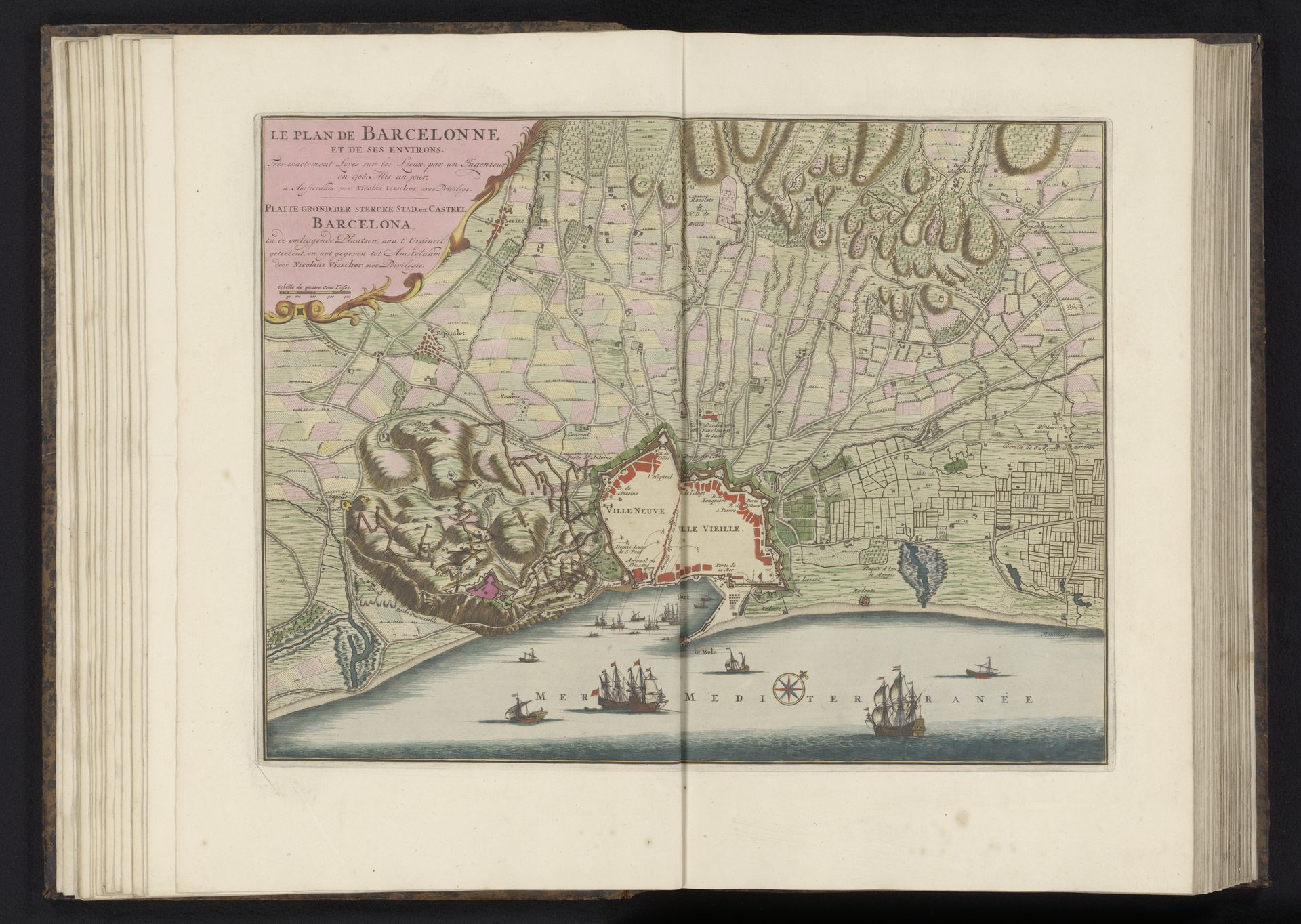
Editor: This is a map of Barcelona from 1706, created by Nicolaes Visscher II. It's a beautiful engraving on paper. What immediately strikes me is how it juxtaposes the natural and the man-made, with that imposing mountain overlooking the clearly fortified city. How do you interpret the visual language used here? Curator: The mountain looming over Barcelona acts as a potent symbol. Throughout history, mountains have represented steadfastness, challenge, and the sublime. But here, next to the detailed grid of the city and those ships dotting the coastline, what do you think the mountain *means* in relation to Barcelona, at this particular historical moment? Editor: Maybe a kind of enduring, natural power against the, comparatively, fragile and new aspirations of the city? Almost a warning? Curator: Precisely. Notice the ships—symbols of trade, power, and potential invasion. A map isn’t just a record of space; it's a record of intent. Barcelona in 1706 was caught in the War of the Spanish Succession. Visscher isn’t merely charting streets, he is presenting a worldview. What endures, what is fleeting, and what might threaten it. What emotional associations does the "sea of ships" bring to your mind? Editor: Anxiety, a kind of maritime pressure cooker… Knowing the history definitely adds a layer of understanding to this image. I hadn't considered maps in such a symbolic context before. Curator: Yes, maps become powerful historical narratives, laden with the symbolic weight of a specific time. Hopefully, from now on you can bring these cultural perspectives to bear in the study of urban landscapes.
Artwork details
- Medium
- print, paper, engraving
- Dimensions
- height 408 mm, width 527 mm
- Location
- Rijksmuseum
- Copyright
- Rijks Museum: Open Domain
Tags
baroque
landscape
paper
cityscape
engraving
Comments
No comments
About this artwork
Editor: This is a map of Barcelona from 1706, created by Nicolaes Visscher II. It's a beautiful engraving on paper. What immediately strikes me is how it juxtaposes the natural and the man-made, with that imposing mountain overlooking the clearly fortified city. How do you interpret the visual language used here? Curator: The mountain looming over Barcelona acts as a potent symbol. Throughout history, mountains have represented steadfastness, challenge, and the sublime. But here, next to the detailed grid of the city and those ships dotting the coastline, what do you think the mountain *means* in relation to Barcelona, at this particular historical moment? Editor: Maybe a kind of enduring, natural power against the, comparatively, fragile and new aspirations of the city? Almost a warning? Curator: Precisely. Notice the ships—symbols of trade, power, and potential invasion. A map isn’t just a record of space; it's a record of intent. Barcelona in 1706 was caught in the War of the Spanish Succession. Visscher isn’t merely charting streets, he is presenting a worldview. What endures, what is fleeting, and what might threaten it. What emotional associations does the "sea of ships" bring to your mind? Editor: Anxiety, a kind of maritime pressure cooker… Knowing the history definitely adds a layer of understanding to this image. I hadn't considered maps in such a symbolic context before. Curator: Yes, maps become powerful historical narratives, laden with the symbolic weight of a specific time. Hopefully, from now on you can bring these cultural perspectives to bear in the study of urban landscapes.
Comments
No comments