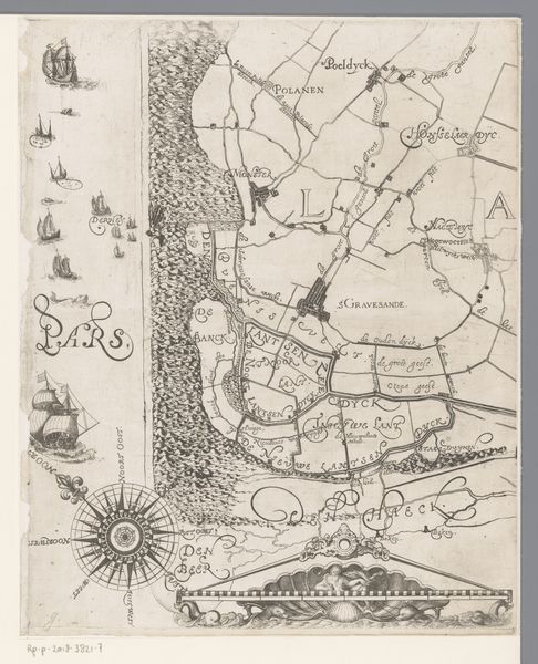
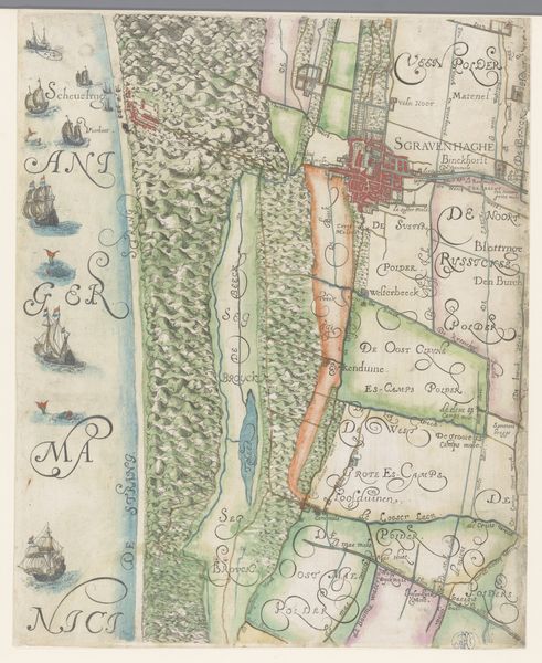
Kaart van het Hoogheemraadschap van Delfland, met 's-Gravenzande en omgeving, deel linksonder 1611 - 1692
0:00
0:00
florisbalthasarszvanberckenrode
Rijksmuseum
painting, watercolor
#
dutch-golden-age
#
painting
#
landscape
#
watercolor
#
cityscape
Dimensions: height 381 mm, width 307 mm
Copyright: Rijks Museum: Open Domain
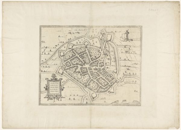
Floris Balthasarsz van Berckenrode created this section of a map of Delfland with 's-Gravenzande and its surroundings. This detailed map provides a glimpse into the geographical and administrative landscapes of the early 17th century Netherlands. Maps like these were not just navigational tools, they were instruments of power, defining territories and influencing economic and military strategies. Berckenrode, through his cartography, participated in shaping how land was perceived and controlled. Notice how the visual language of the map is influenced by the cultural norms of the time, which favored precision and a sense of order. It's interesting to consider how this representation of the land might have reinforced existing social hierarchies, dictating who had access to resources and influence. Reflecting on this map, it's important to consider what remains visible and what is left unseen. It encourages us to think critically about the relationship between power, knowledge, and representation.
Comments
No comments
Be the first to comment and join the conversation on the ultimate creative platform.
More like this