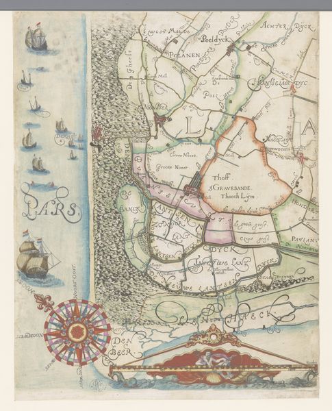
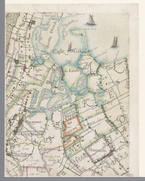
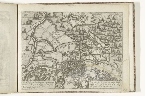
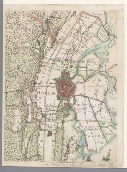
Kaart van het Hoogheemraadschap van Delfland, met Den Haag en omgeving, deel links midden 1611 - 1692
0:00
0:00
florisbalthasarszvanberckenrode
Rijksmuseum
painting, watercolor
#
dutch-golden-age
#
painting
#
landscape
#
watercolor
#
cityscape
#
genre-painting
#
watercolor
Dimensions: height 385 mm, width 311 mm
Copyright: Rijks Museum: Open Domain
Curator: This artwork, “Kaart van het Hoogheemraadschap van Delfland, met Den Haag en omgeving, deel links midden,” offers us a glimpse into the 17th-century Dutch landscape. Dating roughly from 1611 to 1692, it’s a watercolor map held at the Rijksmuseum. What’s your immediate reaction to it? Editor: The pastel hues are rather soothing! The hand-drawn features of the dunes and sailboats evoke a sense of quietude, almost meditative. But behind this serene aesthetic, there’s an implied narrative of land management and control. Curator: Exactly. This isn't just any pretty scene; it's a highly functional document. These detailed renderings weren't merely aesthetic exercises but rather, vital tools for governance, asserting control over land and water, deeply important for the prosperity of the Dutch Golden Age. The Dutch are legendary for these feats of hydrological engineering. Editor: It reflects a society actively reshaping its environment to suit its needs, a constant negotiation between people and nature. We must consider, who benefited from these landscape interventions and at what cost? How did these power dynamics manifest in the visual representation of the land? The inclusion of polders and waterways speaks to Dutch innovations, yes, but it also embodies a colonial ambition to manage and possess the environment. Curator: The artist, Floris Balthasarsz van Berckenrode, really captured this sense of ambition. Notice how the lines between land and water are so clearly delineated. It makes one wonder: where did this drive to categorize and manage everything stem from? The act of naming parcels of land, of organizing, almost possesses that space. Editor: Precisely! Map-making has always been deeply entangled with power structures. Cartography isn't merely descriptive but a powerful form of world-making, inscribing certain social and political orders onto the territory it represents. I wonder, who had access to these maps? What types of negotiations happened behind these divisions and inscriptions of power? Curator: Considering this map now, it becomes a record of a bygone era's dreams and ambitions. The calm colors give way to images of hard fought political control over land. Editor: Definitely, seeing it through this lens underscores the power of art, as not just representation but an embodiment of human-environment interactions.
Comments
No comments
Be the first to comment and join the conversation on the ultimate creative platform.
More like this