graphic-art, print, etching, engraving
#
graphic-art
#
medieval
# print
#
etching
#
landscape
#
etching
#
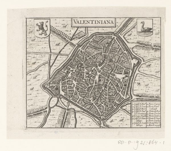
cityscape
#
engraving
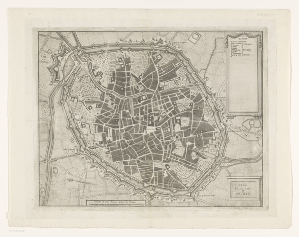
Dimensions: height 497 mm, width 589 mm
Copyright: Rijks Museum: Open Domain
This is an uncolored, anonymous engraving of Valenciennes. Think about this map as more than a geographical document; it's a window into the anxieties and ambitions of its time. The rigid fortifications speak volumes about a society constantly bracing for conflict. But who was this society? Maps like these were often commissioned by the elite, the ruling classes, reflecting their desire for control and order. Yet, within those walls lived countless others – women, laborers, the poor – whose stories are often absent from official narratives. Consider how their lives, their movements, might have been shaped by the very structures meant to protect and confine. This map presents a particular perspective, one that flattens the lived experiences of a diverse populace into a single, defensible image. It invites us to question whose story is being told and whose is being left out. Look closely at the map, and wonder about the untold stories within its borders.
Comments
No comments
Be the first to comment and join the conversation on the ultimate creative platform.
More like this