painting, watercolor
#
dutch-golden-age
#
painting
#
landscape
#
watercolor
#
watercolor
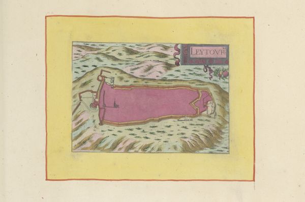
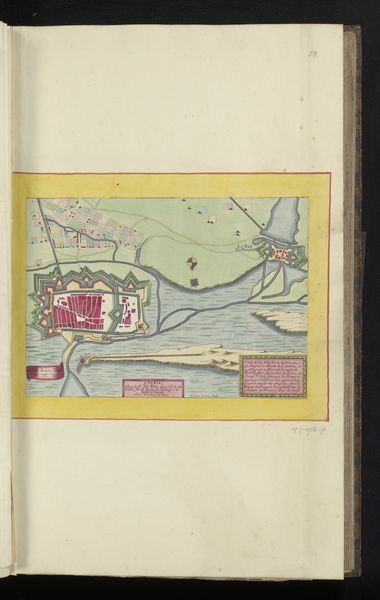
Dimensions: height 103 mm, width 150 mm, height 532 mm, width 320 mm
Copyright: Rijks Museum: Open Domain
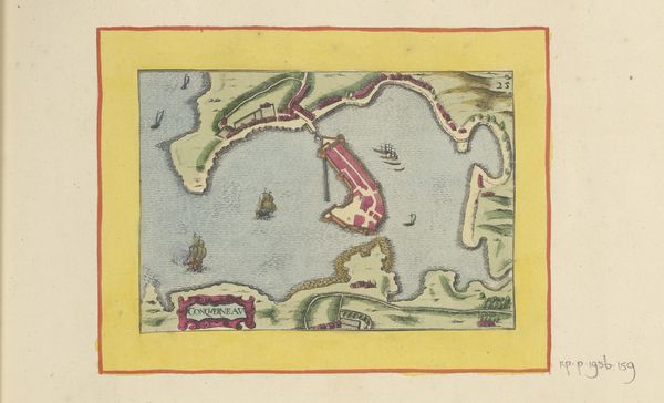
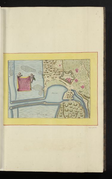
Curator: This delicate watercolor from 1638 is entitled "Kaart van de monding van de rivier Blavet", meaning "Map of the mouth of the Blavet River". Editor: It’s intriguing; it looks both strategic and almost whimsical. The colors are muted, yet the lines feel purposeful, evoking both authority and exploration. Curator: Exactly. As a symbolic form, cartography often illustrates control—claiming territory. Look at how the fortified city is rendered in deep magenta, a striking contrast. Magenta traditionally symbolized royalty and power. This wasn't merely about geography; it's about asserting dominion, painting a specific narrative of control. Editor: That focus makes me think about who this map was for. Was it a practical tool for navigation, or was it about propaganda, to visually represent territorial aspirations? I wonder what stories it could tell about colonial ambitions and their impact? The city itself almost bleeds onto the landscape... Curator: It resonates with psychological tension, doesn’t it? Maps have always played a role in collective consciousness, influencing how we perceive belonging and "otherness". Notice the subtle shading in the sea – an intentional depth? The vessels look almost decorative against the more realistic rendering of the city... Editor: Right, this blending of reality and idealism—even myth—pushes us to question whose vision of Blavet River we’re seeing, whose interests are being served. Even the absence of other cities speaks volumes about hierarchy and marginalization. Curator: The map definitely prompts considerations around the interplay of power, perception, and the role images play in shaping history and the justification for power. It speaks of narratives, both visible and invisibly imprinted upon landscapes, communities, and even individual psyches. Editor: For me, I walk away thinking about who is never 'on the map' even though they live there, the cost of control on a local scale, but as a harbinger for colonialism still present.
Comments
No comments
Be the first to comment and join the conversation on the ultimate creative platform.
More like this