drawing, paper, watercolor, ink
#
drawing
#
baroque
#
dutch-golden-age
#
landscape
#
paper
#
watercolor
#
ink
#
coloured pencil
#
cityscape
#
watercolor
Dimensions: height 117 mm, width 176 mm
Copyright: Rijks Museum: Open Domain
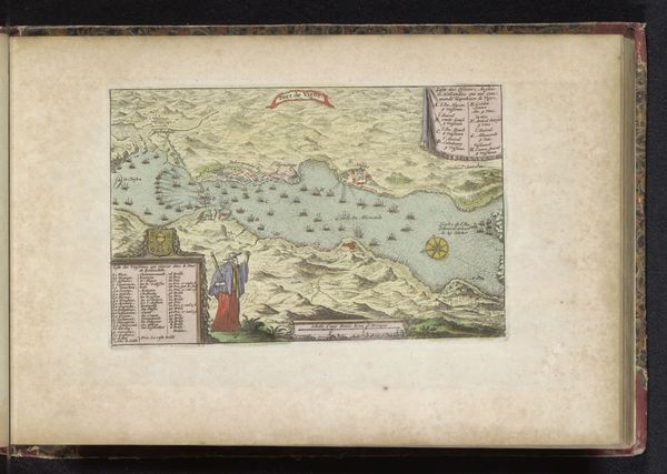
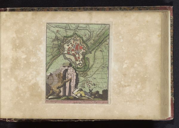
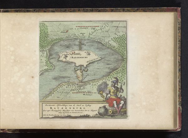
Curator: Let’s turn our attention to “Plattegrond van Venlo,” a cityscape rendered between 1700 and 1735 by an anonymous hand. The artwork employs ink and watercolor on paper, showcasing a detailed, albeit somewhat fantastical, vision of the Dutch city. Editor: My initial reaction is of orderly containment. Everything is so meticulously delineated, like a child’s vision of perfect order—neat lines, pastel washes…It’s a sanitized dream. Curator: The drawing excels at portraying a constructed landscape, privileging structure over nature. Note the acute angles of the fortress walls. How the forms interact. The repetition lends it a certain rhythmic quality. Editor: Precisely, the walls feel almost like protective mother's arms. Fortification wasn't just about defense, but about creating a symbolic womb – shielding its inhabitants from the uncertainties of the world outside. It's all about the idealized safety, an era desperately trying to establish dominion over destiny through structure. Curator: An intriguing perspective, but let’s also acknowledge the piece’s commitment to spatial rendering, even within the demands of cartography. There's depth, line work, color relationships that evoke both function and art. Editor: I suppose the use of watercolor almost feels like the yearning for a gentler time within such militaristic architectural impositions. What colors were consciously deployed here in shaping cultural mindset about living within walled utopias or dystopias, depending on whether you felt entrapped. Curator: And the work achieves remarkable coherence through controlled brushstrokes. Despite the technical draftsmanship required, one can observe clear aesthetic intent and judgment operating in its execution. Editor: All that architectural certainty, ironically drafted on ephemeral paper with water-based paint! We see here not just a snapshot of place, but the tangible hopes and fears inscribed upon a specific time. The walls are metaphors that are loaded! Curator: An apt description. Through visual elements, the artwork explores tensions between natural form and manufactured defense—between aesthetics and function—effectively reflecting its contemporary context. Editor: Indeed, its blend of order and vulnerability renders the symbolic resonance quite potent. The artwork provides a silent reflection, as any effective symbolic carrier should.
Comments
No comments
Be the first to comment and join the conversation on the ultimate creative platform.
More like this