print, engraving
dutch-golden-age
pen sketch
old engraving style
landscape
river
thin linework
pen work
engraving
Dimensions: height 551 mm, width 652 mm
Copyright: Rijks Museum: Open Domain
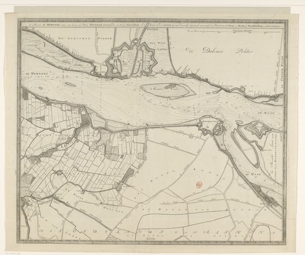
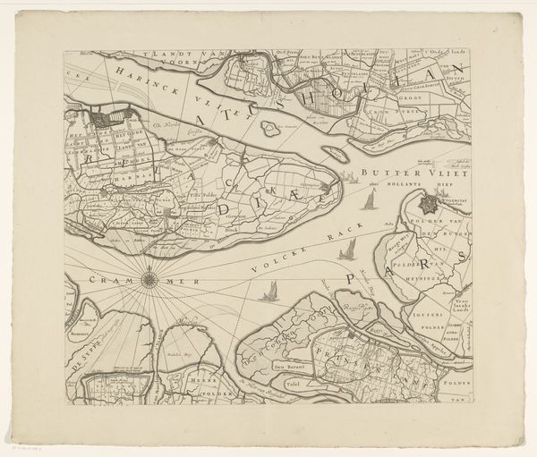
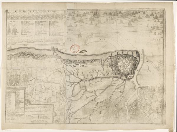
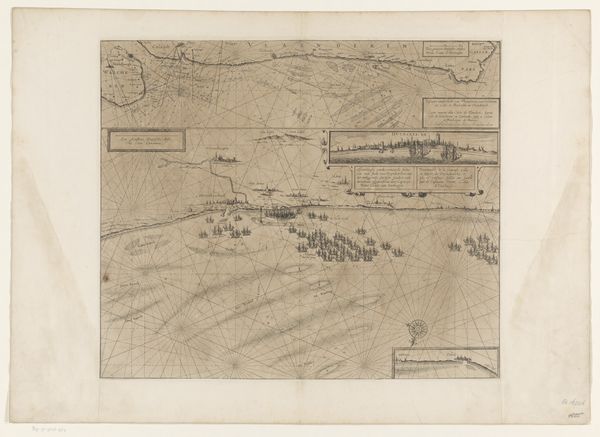
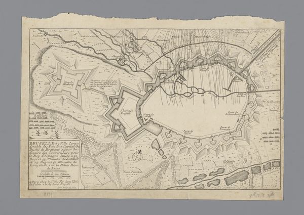
David Coster created this print, "Overzichtsblad bij kaart van de Merwede," sometime between 1686 and 1752. It presents an overview map of the Merwede River in the Netherlands. During Coster’s lifetime, the Dutch Republic was a major maritime power, deeply intertwined with global trade networks and colonial expansion. This map isn't just a geographical document; it is a statement of control over natural resources, rendered in a period when the Dutch identity was being constructed through its relationship to the sea. The detailed hydrographic data, which charts the depths and flow of the river, is a demonstration of Dutch engineering prowess, critical for trade, defense, and land reclamation. Consider the emotional investment in this landscape. For the Dutch, water was both an adversary and a lifeline. The detailed mapping signifies a cultural drive to master the environment, reflecting a complex relationship of fear and respect for water. This map then becomes a narrative of a nation's struggle for survival and prosperity, deeply embedded in its physical surroundings.
Comments
No comments
Be the first to comment and join the conversation on the ultimate creative platform.
More like this