print, etching
#
baroque
# print
#
etching
#
landscape
#
etching
#
cityscape
Dimensions: height 533 mm, width 660 mm
Copyright: Rijks Museum: Open Domain
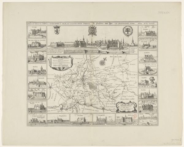
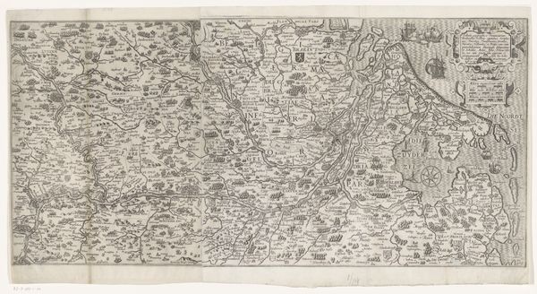
This is Vedastus du Plouich’s map of the district of Ieper, created in 1636. The detailed map offers more than just geographical data; it reflects the social and political landscape of the time. Look closely and you’ll see that the map is adorned with images of castles and prominent buildings. This wasn’t just about showing what was there, it was about emphasizing power, ownership, and the structures that defined social hierarchies. It's a visual assertion of dominance. These weren’t neutral depictions, they reinforced the status quo. Consider the act of mapping itself: who gets to decide what is included, what is emphasized? Maps have always been about power, about claiming territory and shaping narratives. How does this map contribute to our understanding of 17th century social structures? Think about how the ruling classes literally mapped their authority onto the land.
Comments
No comments
Be the first to comment and join the conversation on the ultimate creative platform.
More like this