drawing, paper, ink, pen
drawing
aged paper
toned paper
baroque
pen sketch
sketch book
perspective
paper
personal sketchbook
ink
pen-ink sketch
pen and pencil
pen work
sketchbook drawing
pen
cityscape
history-painting
sketchbook art
Dimensions: height 233 mm, width 330 mm
Copyright: Rijks Museum: Open Domain
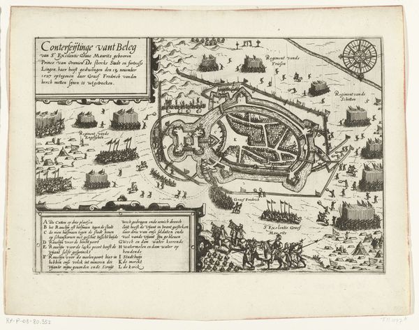
This is a 1726 anonymous engraving, showing the ground plan of Borgoforte, Italy. The print foregrounds Borgoforte’s fortification with a meticulous depiction of walls, moats, and connecting bridges. This image offers insight into the military strategies and territorial ambitions that shaped 18th-century Europe. Borgoforte, strategically located on the banks of the Po River, held immense geopolitical significance. The text above the engraving indicates that Germans fortified the town. This can be understood as one moment in the complex power dynamics between the Italian states and the Holy Roman Empire. This map reflects a society deeply invested in military might and territorial control. The image’s creation reflects an increased interest in geographical accuracy. The "ground plan" and "scale" suggest the rising authority of empirical observation and scientific methodology, as applied to military campaigns and statecraft. Historical maps and plans are invaluable resources for scholars. They invite us to explore the intricate relationship between art, power, and the social conditions that shape our world.
Comments
No comments
Be the first to comment and join the conversation on the ultimate creative platform.