drawing, print, paper, ink, engraving
drawing
medieval
dutch-golden-age
landscape
paper
ink
cityscape
engraving
calligraphy
Dimensions: height 210 mm, width 280 mm
Copyright: Rijks Museum: Open Domain
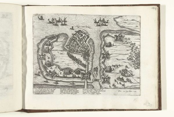
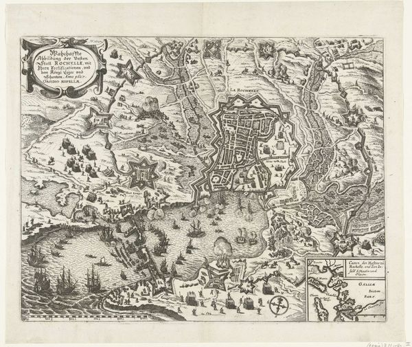
This is Frans Hogenberg's copper engraving, "Kaart van Neuss en omgeving," created in 1585. The map meticulously details Neuss and its surroundings, yet look closer, for a deeper understanding lies within. The map's symbolic weight lies in its depiction of space and power. Note how Neuss, encircled by fortifications, dominates the composition, reflecting its strategic importance. The river Rhine, snaking through the landscape, is more than a geographical feature; it’s a trade artery, a boundary, and a pathway for both commerce and conflict. Consider how similar mapping conventions appear across cultures. Think of the Roman "Tabula Peutingeriana," a similarly stylized map prioritizing key routes and settlements. Such representations speak to a universal need to impose order and understanding on the world. This map is not just ink on paper, but a projection of human ambition and control. It’s a reminder that our perception of space is always shaped by cultural and psychological forces. Reflect on the emotional impulse behind defining and claiming territory, a force as potent today as it was in Hogenberg's time.
Comments
No comments
Be the first to comment and join the conversation on the ultimate creative platform.