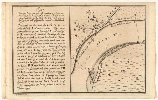
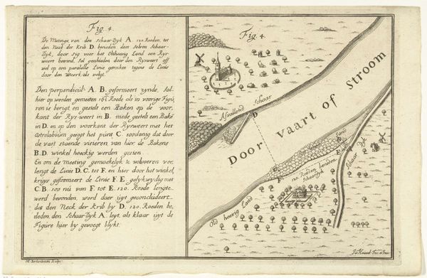
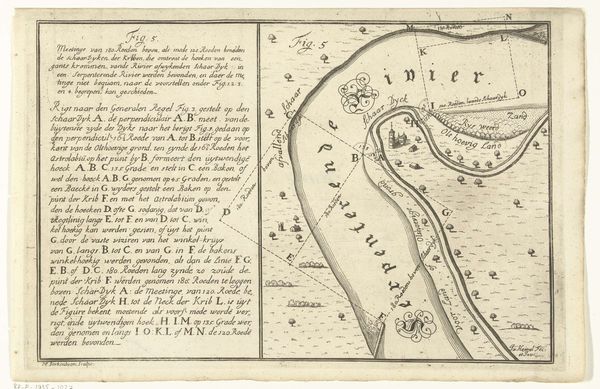
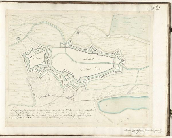
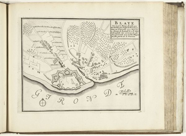
Plattegrond van een bocht in een rivier met het begin van een schaardijk 1650 - 1715
drawing, print, ink, pen, engraving
drawing
dutch-golden-age
pen sketch
old engraving style
landscape
ink
geometric
pen
engraving
Dimensions: height 200 mm, width 302 mm
Copyright: Rijks Museum: Open Domain
This is Martinus Berkenboom’s undated map, "Plattegrond van een bocht in een rivier met het begin van een schaardijk", made using engraving. During the early 18th century in the Netherlands, there was significant investment in cartography, driven by the need for accurate surveys for land management and military strategy. Berkenboom's map reflects this era of meticulous documentation. It uses precise measurements and geometrical principles to depict the landscape. As such, it embodies a distinctly rational and empirical approach to understanding and representing the world. However, there is also a human element to this map. Beyond its technical purpose, this piece also illustrates the complex relationship between the Dutch people and their environment. With much of the Netherlands lying below sea level, land reclamation and water management were crucial. The "schaardijk," a type of dike, symbolizes an ongoing struggle to control and reshape nature. This map also encapsulates an element of vulnerability. Despite the Dutch’s engineering prowess, the ever-present threat of flooding loomed large, creating a sense of collective identity forged through shared experience. The map, then, is not merely a technical drawing, but a cultural artifact reflecting a society grappling with its natural surroundings.
Comments
No comments
Be the first to comment and join the conversation on the ultimate creative platform.