drawing, paper, ink
#
drawing
#
baroque
#
landscape
#
paper
#
ink
Dimensions: height 319 mm, width 402 mm
Copyright: Rijks Museum: Open Domain
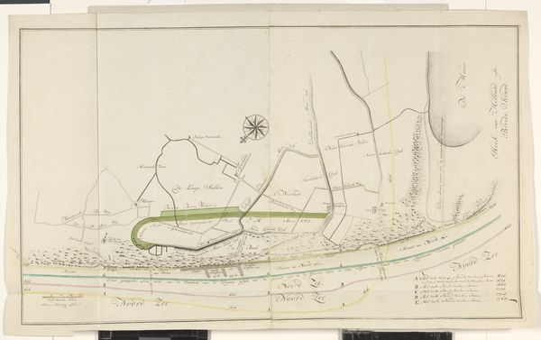
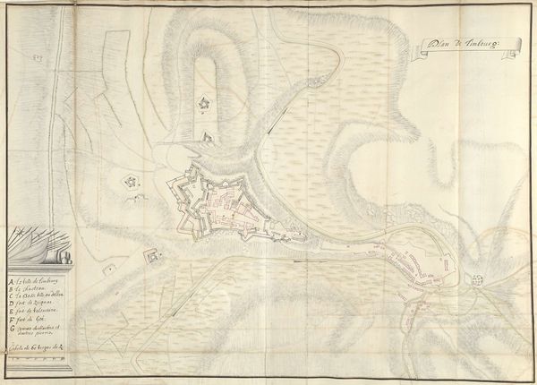
Samuel Du Ry de Champdoré created this map of Zoutleeuw in 1705, using pen and watercolor. Champdoré, a military engineer, made this map during a period of intense conflict in the Low Countries, reflecting the strategic importance of Zoutleeuw as a fortified town. The map not only captures the physical layout of the town but also the societal structures which defined life within its walls. In times of war the residents of Zoutleeuw, much like other fortified towns, would have experienced significant disruptions to their daily lives. Gender roles might have been redefined as women took on responsibilities typically held by men away fighting. Class divisions would have become even more pronounced as resources became scarce. This map invites us to consider how such places both protected and confined those who lived within.
Comments
No comments
Be the first to comment and join the conversation on the ultimate creative platform.
More like this