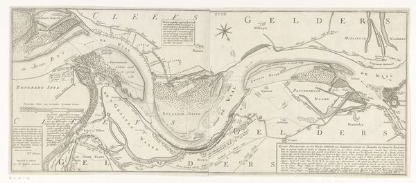
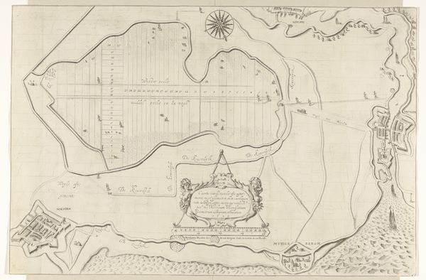
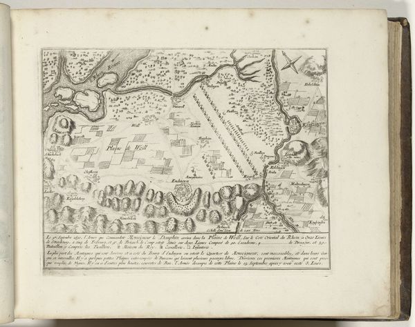
Het Franse leger tegenover het Oostenrijks-Brandenburgse leger bij Turckeim en Colmar, 5 januari 1674 1674
0:00
0:00
gerarduscondet
Rijksmuseum
print, engraving
#
baroque
# print
#
landscape
#
geometric
#
cityscape
#
history-painting
#
engraving
Dimensions: height 261 mm, width 388 mm
Copyright: Rijks Museum: Open Domain
Gerardus Condet created this print of the French and Austrian-Brandenburg armies near Turckheim and Colmar in 1674. Notice the compass rose dominating the upper part of the image, a symbol far more than a mere directional aid. This emblem has ancient roots, appearing in countless maps across centuries, each iteration reflecting the worldview of its time. In medieval cartography, such directional symbols were deeply intertwined with religious and cosmological beliefs, often placing Jerusalem at the center. This fusion of navigation and spiritual orientation speaks to our primal need for understanding our place in the world. Observe how the armies are rigidly aligned, reflecting the rigid societal structures of the time, but also the ever present human need for order. The representation of armies, landscapes and cities in the drawing style of a map shows us the way historical events can be transformed into symbols and metaphors. The compass rose, therefore, embodies a potent blend of scientific exploration and the enduring human quest for meaning.
Comments
No comments
Be the first to comment and join the conversation on the ultimate creative platform.
More like this