drawing, print, etching, ink, engraving
#
drawing
#
pen drawing
# print
#
etching
#
landscape
#
ink
#
engraving
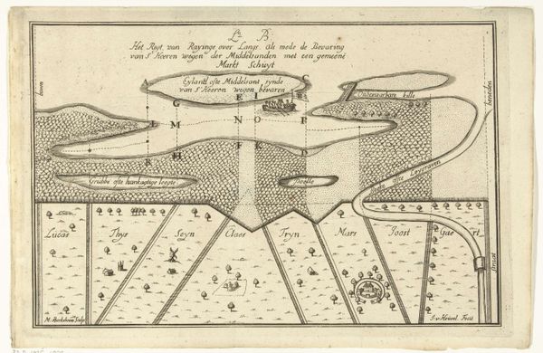
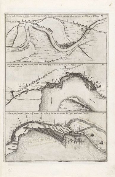
Dimensions: height 200 mm, width 302 mm
Copyright: Rijks Museum: Open Domain
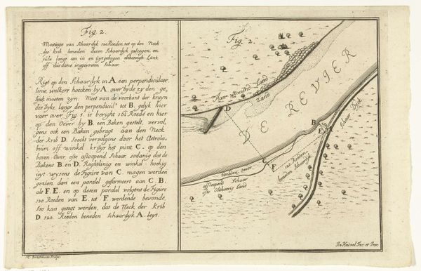
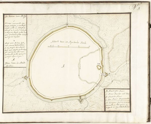
This is Martinus Berkenboom’s ‘Plattegrond van een bocht in een rivier en een schaardijk,’ a river bend and dike map, made around 1700 using engraving. The work offers us a plan view with writing on the left and illustration to the right, all presented in dark ink. This limited colour palette accentuates the linear forms, drawing our eye to the meticulous details. The composition’s structure is defined by its sharp lines and geometric precision. The artist dissects the landscape into segments. These shapes and divisions provide us with a rational understanding of space, yet there is an unsettling contrast. The controlled lines of the map collide with the unpredictable curves of the river and the landscape. Here, Berkenboom isn't simply documenting geography, but imposing a formal order on the natural world. The map itself serves as a semiotic system, using signs and symbols to translate a physical reality into an abstract language. It is in this tension between representation and abstraction that the work finds its complexity. The map invites ongoing interpretation and re-interpretation of the world.
Comments
No comments
Be the first to comment and join the conversation on the ultimate creative platform.
More like this