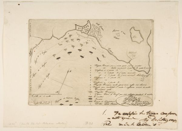
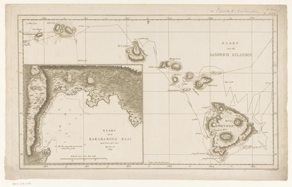
Kaart van de Lucipera eilanden met de verblijfplaatsen van de schipbreukelingen van het stoomschip Willem I, 1837 1837
0:00
0:00
anonymous
Rijksmuseum
print, paper, engraving
#
narrative-art
#
dutch-golden-age
# print
#
paper
#
geometric
#
history-painting
#
engraving
#
realism
Dimensions: height 256 mm, width 342 mm
Copyright: Rijks Museum: Open Domain
Curator: This engraving from 1837, whose creator remains anonymous, presents a cartographic record titled "Kaart van de Lucipera eilanden met de verblijfplaatsen van de schipbreukelingen van het stoomschip Willem I, 1837". Editor: There is a ghostly, delicate air about this print. It is austere. The lines, though precise, seem to tremble with the weight of the story embedded in the graphic marks. What a striking blend of precision and vulnerability. Curator: The artist employs the objective language of mapping. Note the strategic use of line weight to delineate land masses from the surrounding sea. The careful rendering of settlements contrasts starkly with the seemingly empty ocean. There is a strong compositional hierarchy at play as our eyes moves between the different vignettes. Editor: What the careful renderings leave out, or maybe what they unwittingly convey, are questions about the experience of the shipwrecked: Who were these people? How did colonial power structures factor into their predicament, being stranded as they are on islands distant from centers of power? How might their identities shaped their survival? The rigid geometric forms can't contain those human stories. Curator: While it’s critical to ask these humanistic questions, and perhaps attempt to superimpose these sociopolitical frameworks onto the work, the engraving technique itself emphasizes precision. Consider the linear clarity, the exacting manner with which forms are delineated and details recorded—therein lies a significant visual discourse, even if indirect. Editor: I don't dispute that the technical mastery informs our viewing. But, without situating the work in the fraught history of maritime disasters and Dutch colonial enterprises, we risk aestheticizing a document ripe with sociohistorical information. Can the careful execution overshadow a more urgent discourse around exploitation and survival? Curator: No, perhaps these two layers can live alongside each other— the technical rigor and precision of the visual execution co-existing alongside these questions around human cost. Editor: Indeed, in recognizing that friction, perhaps we come to a more textured reading.
Comments
No comments
Be the first to comment and join the conversation on the ultimate creative platform.
More like this