print, paper, engraving
#
neoclacissism
# print
#
landscape
#
paper
#
history-painting
#
engraving
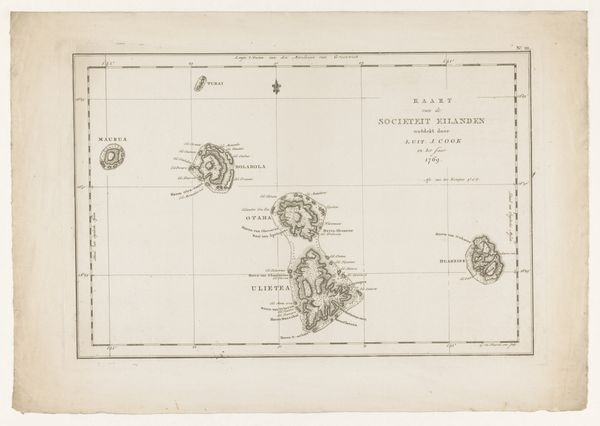
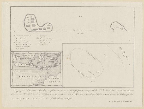
Dimensions: height 252 mm, width 517 mm
Copyright: Rijks Museum: Open Domain
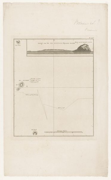
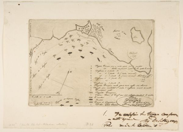
Curator: At first glance, it appears to be a rather clinical depiction, almost detached in its precision. Editor: This engraving on paper, titled "Kaart van de Genootschapseilanden" which translates to "Map of the Society Islands," was created anonymously between 1795 and 1809. It's currently held here at the Rijksmuseum. The work reflects the aesthetic of Neoclassicism. Curator: Given the period, that aestheticization interests me; maps weren't just about wayfinding, they were instruments of power. This neat, gridded representation of Otaheiti and other islands abstracts the human cost of exploration and colonization. Editor: Absolutely. The very act of mapping claims territory, transforming land and resources into commodities ripe for extraction. Note the deliberate inscription indicating its intent for naval use "Stroos, Wallace, Controversy or Weak in de Jaren 1767, 1769, 1809". Curator: It's not just geography being represented here, but also a claim on history, reshaping cultural narratives within that colonial framework. Who were these islands, and who decided to impose new borders? The silent erasure is deafening. Editor: Yes, consider the materials, too: paper, ink, the engraving process itself. These materials, traded and transported, highlight the interconnection of resource exploitation, labor, and the creation of this knowledge-artifact. Curator: It forces us to think about what’s missing—the Indigenous perspectives, the stories disrupted by these expeditions. I would also include consideration for gender since sailors and scientists where all men, whose perspectives were shaped by the gender bias of their period. Editor: Agreed. Its neat precision stands in stark contrast to the messy reality of those encounters, underscoring art’s capacity for both documentation and distortion. Curator: So, let us remember that cartography itself is not neutral, it is a construction of cultural narratives with profound, real-world consequences on how identities and political claims are presented even today. Editor: Ultimately, this "Map of the Society Islands" asks us to grapple with the tangible and the intangible— the making of empire alongside the making of meaning.
Comments
No comments
Be the first to comment and join the conversation on the ultimate creative platform.
More like this