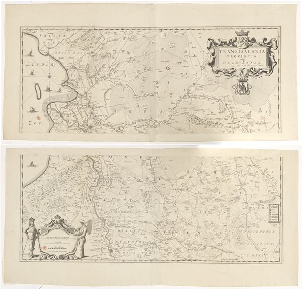
print, paper, engraving
#
dutch-golden-age
# print
#
landscape
#
paper
#
geometric
#
engraving
Dimensions: height 414 mm, width 529 mm
Copyright: Rijks Museum: Open Domain
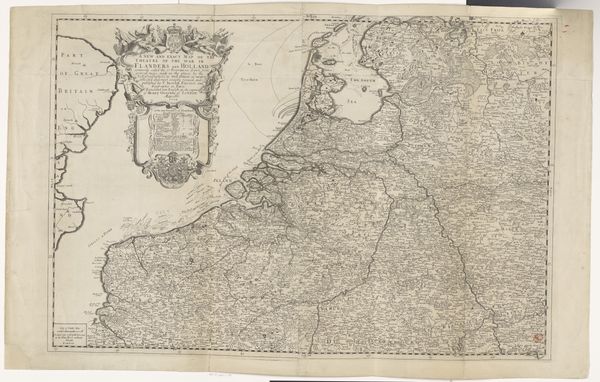
Curator: Here we have a fascinating print titled "Kaart van het graafschap Vlaanderen," or "Map of the County of Flanders," dating back to sometime between 1636 and 1649. It's currently housed right here in the Rijksmuseum. Editor: My initial reaction? It’s incredibly detailed! I'm immediately struck by the delicate lines etching out this antique vision. So intricate. It's hard to believe it was all done by hand, painstakingly creating a coherent image, one tiny incision at a time. It makes me think about the amount of effort the author put in and their feelings about that land... It must have been significant. Curator: Precisely! Its creator, though anonymous, used engraving on paper, showcasing the landscape style so prevalent in Dutch Golden Age cartography. Beyond mere geography, the map incorporates geometric principles, fulfilling not only practical, but also artistic intentions. Notice how settlements are signified with what appear to be little buildings... a tiny icon for human civilization at large. Editor: It reminds me of wandering around in a dreamscape made of tiny threads, each telling stories that intertwine as they shape what we know of Flanders today. When you gaze at it long enough you find yourself absorbed in every little feature – the rivers flowing through that terrain or all those meticulously marked regions each having its own tales – offering an opening into history… And I also find the rendering of the North Sea evocative; it’s not merely functional—it evokes a sense of sublime awe! Curator: And that "Mare Germanicum," as they called it then, served as both boundary and conduit. Maps of this era held a double weight: they plotted physical territories and declared intentions—territorial claims or expanding influences in what became an act of power and assertion of cultural importance. You'll notice symbolic motifs that are loaded with cultural significance—cartouches filled with iconography—and their language served not only spatial indication, but ideological endorsement. Editor: Absolutely. In modern day context, our reliance is now directed onto digital renderings by satellite, thereby taking away their personal, emotional connection... Maybe something gets missed when machines instead of humans render our geographies, such human-crafted pieces echo personal histories far more greatly as artworks in themselves than simple geographic indicators allow us to remember: it acts as evidence to both what came directly earlier, as how cultural values get expressed. It acts beyond its utility. Curator: A testament to an intersection between science and artistic representation – holding keys towards the perception of not just land mass itself—but moreover towards past selves as seen through spatial perspective... Editor: Agreed. Something deeply human.
Comments
No comments
Be the first to comment and join the conversation on the ultimate creative platform.
More like this