1693 - 1695
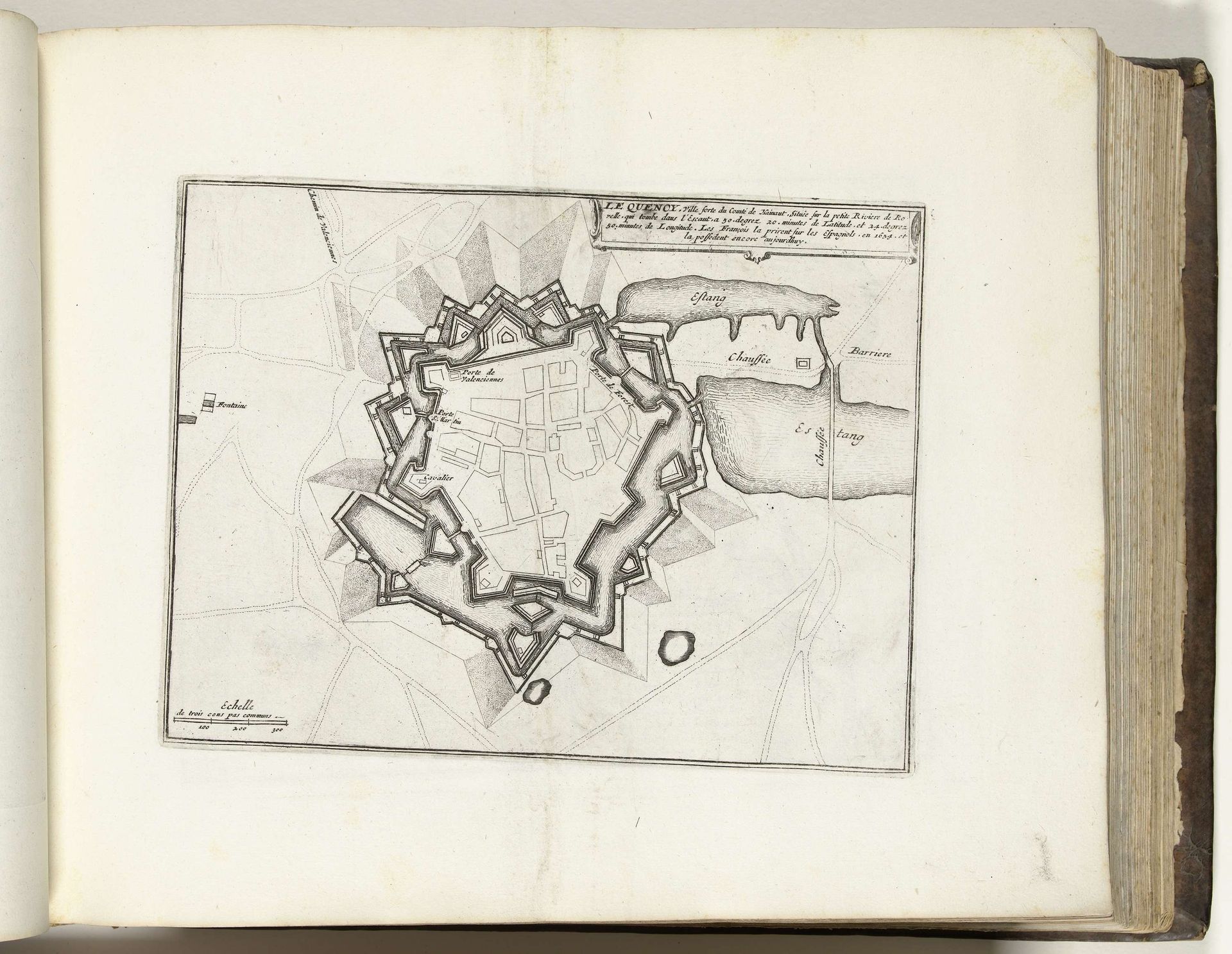
Plattegrond van le Quesnoy, ca. 1693-1695
Anonymous
@anonymousLocation
RijksmuseumListen to curator's interpretation
Curatorial notes
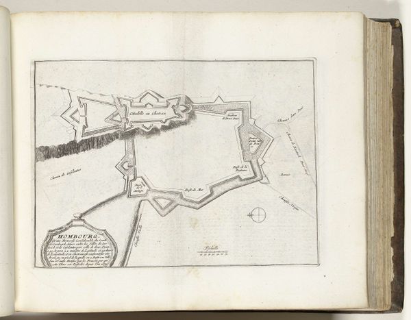
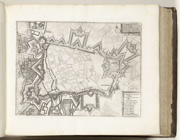
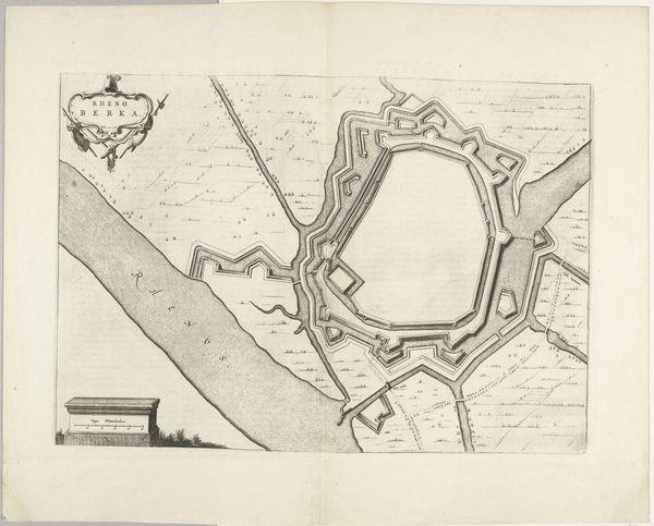
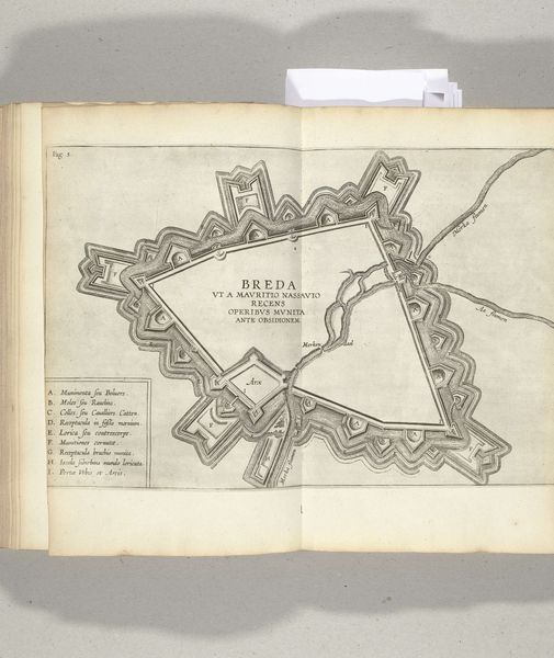
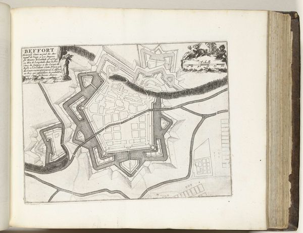
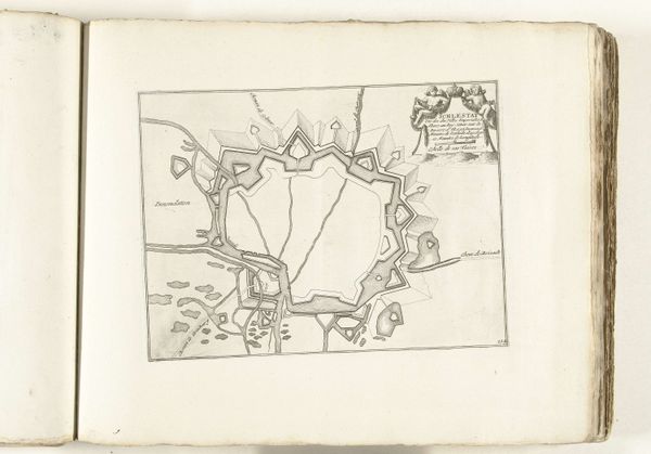
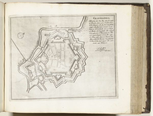
This detailed map of Le Quesnoy was etched in ink onto paper around 1693-1695 by an anonymous artist. The choice of etching as a medium speaks volumes. Unlike painting, which emphasizes the artist's individual touch, etching is a printmaking process, allowing for the reproduction and distribution of images. Here, the clean lines and precise details of the city's fortifications and layout are emphasized in print, highlighting the importance of accuracy and standardization. The linear design mimics the methodical work of the architect in his planning of the city, further evidence of the skilled craftsmanship and technical expertise required for both the creation and execution of this piece. Maps like this were crucial tools for military strategy and urban planning, reflecting the growing importance of cartography in the era of exploration and colonization. By focusing on the materials and processes used in its creation, we can understand this map not just as a representation of space, but as a material object imbued with social and cultural significance, blurring the lines between art, craft, and utility.