print, engraving
landscape
cityscape
northern-renaissance
engraving
Dimensions: height 287 mm, width 428 mm
Copyright: Rijks Museum: Open Domain
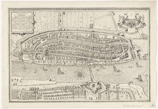
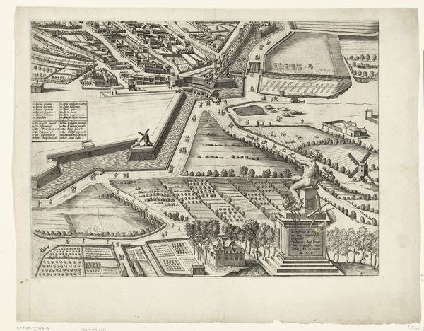
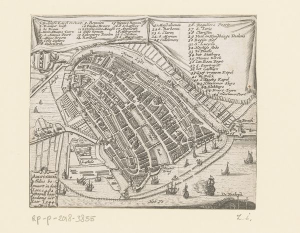
Paulus van Wtewael's "Plattegrond van Medemblik" presents us with a detailed bird's-eye view of the town, articulated through precise lines and careful composition. The monochromatic medium amplifies the structural clarity of the town’s layout, offering a sense of order and containment. The tightly packed buildings, interwoven streets, and robust fortifications create a semiotic system that speaks to the town's identity. The map is not merely a visual representation but a statement of power, control and civic pride. We can view the town as a text: the walls and canals define boundaries, the buildings signify social structures, and the open spaces suggest communal life. The detailed rendering invites us to interpret the visual elements as signs, each contributing to an understanding of the town's historical and social fabric. The cartographic lines simultaneously define and confine the town's space. By imposing a grid-like order, the map reflects an attempt to tame the natural world. It encourages us to consider how such representations shape our understanding of space, power, and the relationship between humanity and its environment.
Comments
No comments
Be the first to comment and join the conversation on the ultimate creative platform.