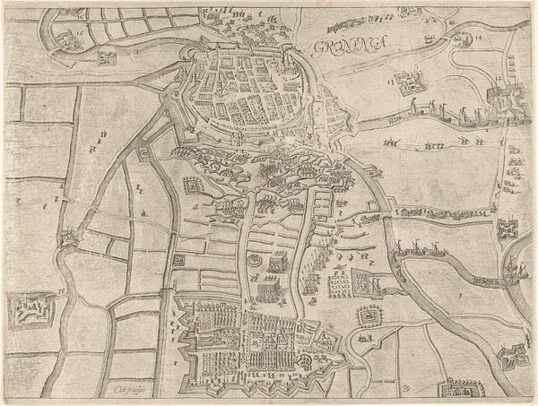
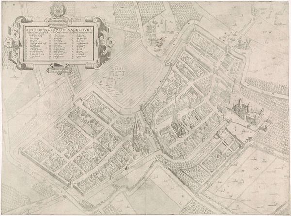
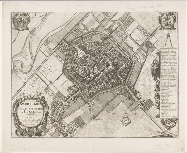
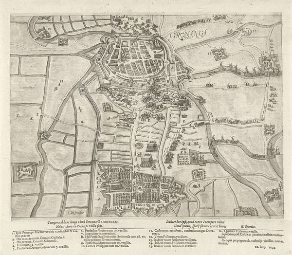
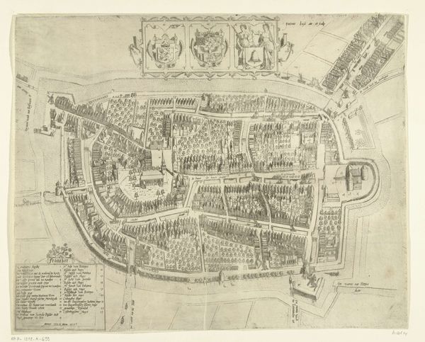
graphic-art, print, engraving
#
graphic-art
#
baroque
# print
#
cityscape
#
engraving
Dimensions: height 482 mm, width 574 mm
Copyright: Rijks Museum: Open Domain
Curator: Here we have Jan van Vianen's "Plattegrond van Utrecht," an engraving dating roughly between 1695 and 1751, housed right here at the Rijksmuseum. It's quite detailed, wouldn't you say? Editor: My goodness, look at the density! The composition feels incredibly dense, almost claustrophobic. It’s hard to believe people actually lived in such tight quarters. How large would you say it is? Curator: It’s impressive, isn't it? This kind of precision engraving required skill, you can appreciate the labor that went into etching all the individual buildings and streets. Notice the technique here— the use of line to represent both physical structures and symbolic power. Editor: Yes, there is some power dynamics here. I wonder how this map affected the social space of the city. Did the production and circulation of these maps play a role in establishing, controlling, or even resisting authority? Who commissioned this piece? Who was the intended audience? Curator: This was likely a project for wealthy merchants or civic leaders wanting to project their authority through representations of the urban landscape. Maps like these demonstrated control over resources and trade routes. Editor: True, the city depicted as an asset. What is absent from this representation? Were lower economic populations included in this type of cartography? This is a powerful display of space in which those who commissioned the art participate. Curator: Perhaps focusing on the elites. Also the tools used, and the printmaking process were very different compared to today. We tend to lose sight of the sheer physicality of creation now that so much is digitized. Editor: Thinking about the city, too, and how it’s changed since. It’s almost nostalgic looking at it this way. You begin to consider questions around urban planning, what was kept and what was lost with time. Curator: Exactly, a material object that spurs conversation across time. That really highlights the purpose of examining the creation of the city's plan during that time. Editor: Yes! So, while the physical engraving captures one moment, our analysis adds layers of contemporary dialogues, bringing the past into our present. Curator: An object can offer so many rich ways of thinking through time and space!
Comments
No comments
Be the first to comment and join the conversation on the ultimate creative platform.
More like this