print, paper, engraving
#
pen drawing
# print
#
pen illustration
#
old engraving style
#
landscape
#
paper
#
ink line art
#
11_renaissance
#
line
#
pen work
#
engraving
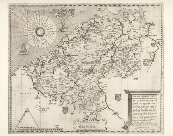
Dimensions: height 387 mm, width 520 mm
Copyright: Rijks Museum: Open Domain
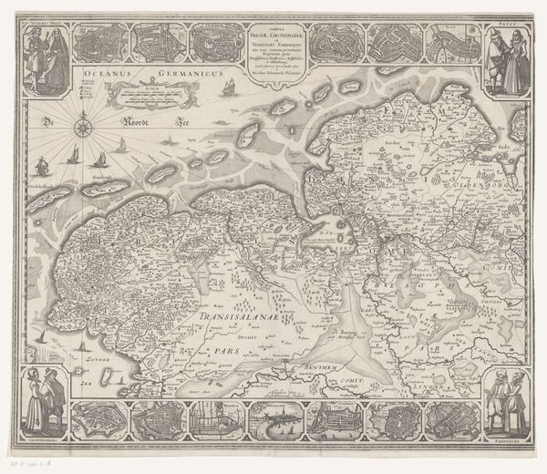
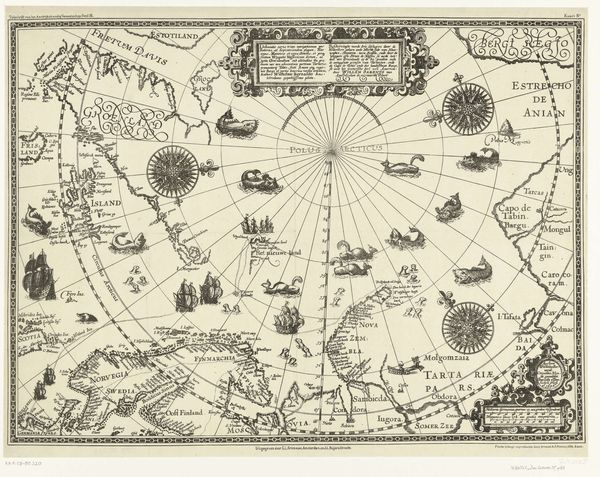
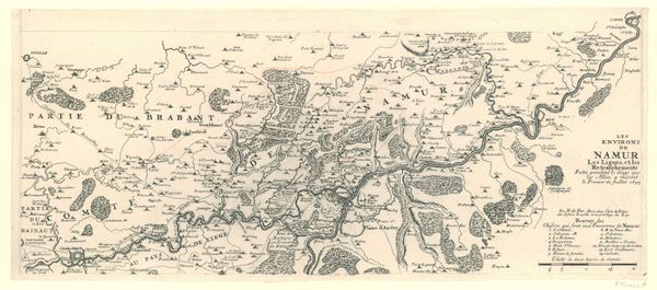
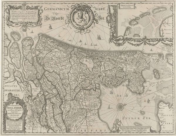
Editor: We're looking at "Kaart van Vlaanderen en Henegouwen," or "Map of Flanders and Hainaut," a print from 1555 by Jacob Bos. It's incredible how much detail he manages to capture just with lines and text! What strikes me is that it's more than a geographical document; it’s a statement of power and knowledge. What are your initial thoughts on this map? Curator: Indeed! As a historian, I see this map as a product of its time. Cartography in the 16th century wasn't just about accurately representing space; it was deeply intertwined with politics and societal values. These maps were commissioned by rulers to define their territories, assert control, and project their image. Notice how prominently certain cities and regions are depicted – are these the areas of particular political or economic significance to the commissioner? Editor: That makes sense. I hadn’t thought about the choices of what to include being politically motivated. What about the embellishments like the crests or the compass rose? Curator: Precisely! The elaborate cartouches, heraldic symbols, and even the compass rose were not merely decorative. They functioned as symbols of authority, lineage, and even religious affiliation. They provided clues as to the patrons and consumers. In whose interest was it to have such a document made available, and to whom? Think about who would possess such a luxury. Editor: So, deciphering these symbols gives us insight into the map's social function at the time. Are there other visual elements we should pay attention to? Curator: Consider the landscape: How is it represented? Are natural resources highlighted? Does the style of depiction align with other artistic trends of the period? By considering these elements, we can uncover the social and cultural priorities embedded within the map's very structure. This becomes less of an objective depiction of geography, but a subjective political statement. Editor: Wow, I will never look at a map the same way again! I really appreciate you showing me the deeper contexts at play. Curator: It's a continuous process of inquiry and analysis. Each visual element acts as a clue, revealing layers of historical context and power dynamics. Keep questioning the 'why' behind these artistic choices, and you'll unlock a rich understanding of art's role in society.
Comments
No comments
Be the first to comment and join the conversation on the ultimate creative platform.
More like this