print, engraving
#
dutch-golden-age
# print
#
landscape
#
geometric
#
engraving
Dimensions: height 397 mm, width 517 mm
Copyright: Rijks Museum: Open Domain
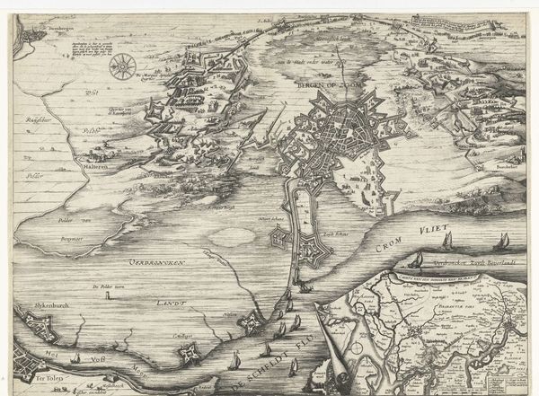
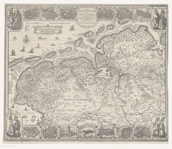
Salomon Rogiers created this map of Holland in the first half of the 17th century, a period when cartography was as much about national identity as it was about navigation. Notice how the map isn't just a neutral depiction of land; it's a statement of Dutch presence and power. Consider what it meant to map a territory during a time of exploration and colonization. Mapping wasn't merely a scientific endeavor, but also a political act that claimed ownership and control. The detailed rendering of the landscape is a testament to the importance of land and resources. The map is intricately detailed, but who did it serve? How did it shape the perception and administration of the Dutch landscape? The visual language here asserts dominance, influencing how both the Dutch and the world understood this region. Think about how maps continue to shape our understanding of the world, often reinforcing particular perspectives and power structures.
Comments
No comments
Be the first to comment and join the conversation on the ultimate creative platform.
More like this